|
search place name
|
||
Calintaan (Mindoro Occidental, Philippines)Calintaan is a town in the Mindoro Occidental region of Philippines. An overview map of the region around Calintaan is displayed below.
regional and 3d topo map of Calintaan, Philippines ::

Calintaan airports ::
The nearest airport is KLO - Kalibo, located 184.9 km south east of Calintaan.
Other airports nearby include MNL - Manila Ninoy Aquino Intl (214.0 km north), SJI - San Jose Antique (227.4 km south east), ILO - Iloilo (270.1 km south east), BCD - Bacolod (304.4 km south east), Nearby towns ::
Calintaan (1.4km south west) //
Patay Ilog (1.6km north) //
Balagbagan (1.9km north east) //
Gawaygaway (2.5km south east) //
Piri (3.8km north east) //
Iriron (4.8km north) //
Cahagnayaan (5.0km south) //
Sapaton (6.6km north east) //
Magaran (8.0km south) //
Banos (8.7km north) //
[all distances 'as the bird flies' and approximate] 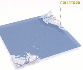 Places with similar names to Calintaan, Philippines ::
// Cline Town (SL)
// Calanutan (PH)
// Calinta-an (PH)
// Calintaan (PH)
// Calintaan (PH)
// Calunetan (PH)
// Kaliantana (PH)
// Clanton (US)
// Clinton (US)
// Kleinotten (AT)
Disclaimer :: Information on this page comes without warranty of any kind |
||
|
Where is Calintaan? Elevation and coordinates ::
Latitude (lat): 12°34'32"N Longitude (lon): 120°56'34"E
Elevation (approx.): 10m (map arrows pan, magnifying glasses zoom) |
||
|
Visiting Calintaan? Hotel/Accommodation ::
Book a hotel in Calintaan Travel Guide ::
Buy a travel guide for Philippines rental cars ::
car rental offers GPS waypoint ::
download a GPX waypoint (PoI) of Calintaan for your GPS receiver
|
||