|
search place name
|
||
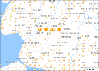
Canangca-an (Bohol, Philippines)Canangca-an is a town in the Bohol region of Philippines. An overview map of the region around Canangca-an is displayed below.
regional and 3d topo map of Canangca-an, Philippines ::
Canangca-an airports ::
The nearest airport is NOP - Masbate Mactan Cebu Intl, located 63.6 km north of Canangca-an.
Other airports nearby include DGT - Dumaguete (83.9 km south west), BCD - Bacolod (150.4 km north west), CGY - Ladag Cagayan De Oro (162.9 km south east), ILO - Iloilo (188.2 km north west), Nearby towns ::
Candasig (0.0km north) //
Magsija (1.8km east) //
Maslog (1.8km east) //
Canapnapan (2.2km south west) //
Baucan (2.6km north east) //
Patrocinio (2.7km west) //
Cantalid (3.0km east) //
Dorol (3.3km north east) //
Balilihan (3.6km north east) //
Datag (3.7km east) //
Cabad (3.8km east) //
Loreto (3.8km west) //
Bahaybahay (4.1km south east) //
Viga (4.1km north west) //
Angilan (4.5km north west) //
Busao (4.7km north west) //
Pandol (4.7km south west) //
Malayo (5.0km west) //
Sikatuna (5.3km south east) //
Cancatac (5.4km south) //
Cambagui (5.5km east) //
Boctol (5.7km north east) //
Sagasa (5.9km north) //
Badiang (5.9km south) //
Corella (5.9km south west) //
Anislag (5.9km south west) //
Lagtangan (5.9km south east) //
Calinginan (6.3km east) //
Bantolinao (6.6km north) //
[all distances 'as the bird flies' and approximate]  Places with similar names to Canangca-an, Philippines ::
// Canangcaan (PH)
// Kanangca-an (PH)
Disclaimer :: Information on this page comes without warranty of any kind |
||
|
Where is Canangca-an? Elevation and coordinates ::
Latitude (lat): 9°44'0"N Longitude (lon): 123°57'0"E
Elevation (approx.): 70m (map arrows pan, magnifying glasses zoom) |
||
|
Visiting Canangca-an? Hotel/Accommodation ::
Book a hotel in Canangca-an Travel Guide ::
Buy a travel guide for Philippines rental cars ::
car rental offers GPS waypoint ::
download a GPX waypoint (PoI) of Canangca-an for your GPS receiver
|
||