|
search place name
|
||
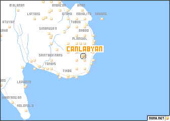
Canlabyan (Southern Leyte, Philippines)Canlabyan is a town in the Southern Leyte region of Philippines. An overview map of the region around Canlabyan is displayed below.
regional and 3d topo map of Canlabyan, Philippines ::
Canlabyan airports ::
The nearest airport is TAC - Tacloban Daniel Z Romualdez, located 107.2 km north of Canlabyan.
Other airports nearby include NOP - Masbate Mactan Cebu Intl (139.2 km west), CGY - Ladag Cagayan De Oro (218.2 km south), DGT - Dumaguete (238.3 km south west), Nearby towns ::
Capacuhan (0.0km north) //
Tagup-on (0.0km north) //
Anahawan (1.5km south east) //
Lo-oc (1.9km south) //
San Vicente (1.9km south) //
Landakan (1.9km south) //
Manigawong (1.9km north) //
Hugpa (1.8km west) //
Lungsoddaan (1.8km east) //
Lewing (1.8km east) //
Kamagong (1.8km west) //
Kaguingkingan (1.8km west) //
Mahalo (2.4km north east) //
Amagusan (2.6km south) //
Calinta-an (2.6km south west) //
Maulingon (2.6km south west) //
Pigut (2.6km north west) //
Maaslom (2.6km north west) //
Paguha (2.6km north east) //
Kamaligan (3.7km north) //
Plaridel (3.9km north) //
Barsahan (4.1km north west) //
Kogon (4.1km south west) //
Bobon (4.1km south west) //
Kamaligan (4.1km north east) //
Amaga (4.1km north west) //
Katiwing (4.1km north east) //
Agay-ay (4.4km south west) //
Sagbok (4.7km north east) //
[all distances 'as the bird flies' and approximate]  Places with similar names to Canlabyan, Philippines :: Disclaimer :: Information on this page comes without warranty of any kind |
||
|
Where is Canlabyan? Elevation and coordinates ::
Latitude (lat): 10°17'0"N Longitude (lon): 125°15'0"E
Elevation (approx.): 98m (map arrows pan, magnifying glasses zoom) |
||
|
Visiting Canlabyan? Hotel/Accommodation ::
Book a hotel in Canlabyan Travel Guide ::
Buy a travel guide for Philippines rental cars ::
car rental offers GPS waypoint ::
download a GPX waypoint (PoI) of Canlabyan for your GPS receiver
|
||