|
search place name
|
||
Canvirtudes (Leyte, Philippines)Canvirtudes is a town in the Leyte region of Philippines. An overview map of the region around Canvirtudes is displayed below.
regional and 3d topo map of Canvirtudes, Philippines ::

Canvirtudes airports ::
The nearest airport is TAC - Tacloban Daniel Z Romualdez, located 18.3 km east of Canvirtudes.
Other airports nearby include NOP - Masbate Mactan Cebu Intl (137.1 km south west), BCD - Bacolod (220.0 km west), DGT - Dumaguete (267.0 km south west), Nearby towns ::
Dapdap (0.6km south east) //
Pepita (1.2km south east) //
Capiz (1.4km north west) //
Buri (1.5km south east) //
Dapdap (1.7km north east) //
Esperanza (1.8km east) //
Mudburon (1.9km north) //
Kadajunan (1.9km north) //
Lingayon (1.9km north) //
Patang (2.2km south west) //
Bugho (2.6km north west) //
Aslun (2.6km south east) //
Astorga (3.3km south) //
Alangalang (3.3km north west) //
San Pedro (3.4km north) //
Salvador (3.6km north east) //
San Isidro (3.6km west) //
Caridad (3.7km south) //
Calogcog (3.6km east) //
Kabungaan (3.9km south west) //
Lourdes (4.0km north) //
Canlaodun (4.1km south east) //
Lilinti-an (4.1km south east) //
Bolod (4.1km south west) //
Burabud (4.1km north west) //
Buenavista (4.1km north west) //
Gapas (4.1km west) //
San Diego (4.3km north) //
San Juan (4.3km south east) //
[all distances 'as the bird flies' and approximate] 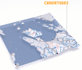 Places with similar names to Canvirtudes, Philippines :: Disclaimer :: Information on this page comes without warranty of any kind |
||
|
Where is Canvirtudes? Elevation and coordinates ::
Latitude (lat): 11°11'0"N Longitude (lon): 124°52'0"E
Elevation (approx.): 34m (map arrows pan, magnifying glasses zoom) |
||
|
Visiting Canvirtudes? Hotel/Accommodation ::
Book a hotel in Canvirtudes Travel Guide ::
Buy a travel guide for Philippines rental cars ::
car rental offers GPS waypoint ::
download a GPX waypoint (PoI) of Canvirtudes for your GPS receiver
|
||