|
search place name
|
||
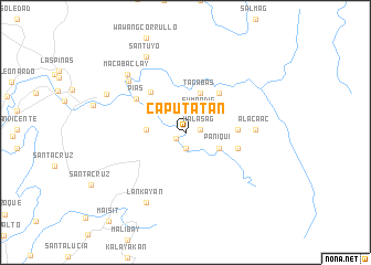
Caputatan (Nueva Ecija, Philippines)Caputatan is a town in the Nueva Ecija region of Philippines. An overview map of the region around Caputatan is displayed below.
regional and 3d topo map of Caputatan, Philippines ::
Caputatan airports ::
The nearest airport is MNL - Manila Ninoy Aquino Intl, located 89.8 km south of Caputatan.
Other airports nearby include BAG - Baguio (129.0 km north west), Nearby towns ::
Bayocboc (1.1km south west) //
Calios (1.5km east) //
Kalasag (1.5km east) //
Minalungao (1.6km south) //
Maipet (2.6km north east) //
Sumandig (2.6km north east) //
Paniqui (3.6km south east) //
Apugan (3.9km west) //
Tagabas (4.3km north) //
Malinta (5.2km north east) //
Kay-Upus (5.1km east) //
Bangasay (5.1km east) //
Pantay Sebugo (5.3km north west) //
Mantahilan (5.3km east) //
Pias (5.9km north west) //
Alacaac (6.9km east) //
Rio Chico (7.6km north west) //
Lankayan (8.1km south west) //
Macabaclay (8.1km north west) //
Santuyo (8.6km north west) //
General Tinio (8.6km north west) //
[all distances 'as the bird flies' and approximate] 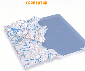 Places with similar names to Caputatan, Philippines ::
Disclaimer :: Information on this page comes without warranty of any kind |
||
|
Where is Caputatan? Elevation and coordinates ::
Latitude (lat): 15°18'51"N Longitude (lon): 121°7'10"E
Elevation (approx.): 69m (map arrows pan, magnifying glasses zoom) |
||
|
Visiting Caputatan? Hotel/Accommodation ::
Book a hotel in Caputatan Travel Guide ::
Buy a travel guide for Philippines rental cars ::
car rental offers GPS waypoint ::
download a GPX waypoint (PoI) of Caputatan for your GPS receiver
|
||