|
search place name
|
||
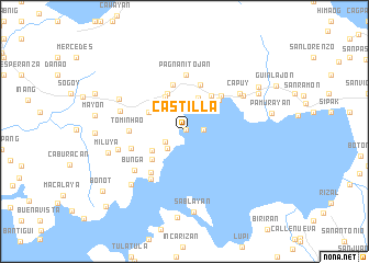
Castilla (Sorsogon, Philippines)Castilla is a town in the Sorsogon region of Philippines. An overview map of the region around Castilla is displayed below.
regional and 3d topo map of Castilla, Philippines ::
Castilla airports ::
The nearest airport is KLO - Kalibo, located 215.7 km south west of Castilla.
Other airports nearby include TAC - Tacloban Daniel Z Romualdez (227.6 km south east), Nearby towns ::
Loreto (0.2km north east) //
Salvacion (0.2km north east) //
Pandan (1.9km east) //
Bagongsirang (1.9km east) //
Caburacan (1.9km east) //
Comadcad (1.9km east) //
Libtong (1.9km east) //
Sagasa (2.2km south west) //
Corocauayan (2.4km south west) //
Sambang (2.4km north) //
Buenavista (3.7km north) //
Amomonting (3.7km south west) //
San Isidro (3.9km north west) //
Pili (4.1km north west) //
Monte Carmelo (4.0km north west) //
Dancalan (4.2km north west) //
Manaba (4.3km south west) //
Bulabug (4.5km north east) //
Rizal (4.7km north east) //
La Union (4.9km north) //
Dumadlangan (5.0km north) //
Bucalbucalan (5.1km north east) //
Cagtocaw (5.3km south west) //
Tominhao (5.5km west) //
Bagalayag (5.6km west) //
Pagnanitojan (5.7km north) //
Bantaron (5.9km south west) //
Bunga (6.4km south west) //
San Rafael (6.7km west) //
[all distances 'as the bird flies' and approximate]  Places with similar names to Castilla, Philippines ::
Disclaimer :: Information on this page comes without warranty of any kind |
||
|
Where is Castilla? Elevation and coordinates ::
Latitude (lat): 12°56'55"N Longitude (lon): 123°52'56"E
(map arrows pan, magnifying glasses zoom) |
||
|
Visiting Castilla? Hotel/Accommodation ::
Book a hotel in Castilla Travel Guide ::
Buy a travel guide for Philippines rental cars ::
car rental offers GPS waypoint ::
download a GPX waypoint (PoI) of Castilla for your GPS receiver
|
||