|
search place name
|
||
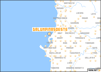
Dalumpinas Oeste (La Union, Philippines)Dalumpinas Oeste is a town in the La Union region of Philippines. An overview map of the region around Dalumpinas Oeste is displayed below.
regional and 3d topo map of Dalumpinas Oeste, Philippines ::
Dalumpinas Oeste airports ::
The nearest airport is BAG - Baguio, located 44.4 km south east of Dalumpinas Oeste.
Nearby towns ::
Dinanum (1.8km east) //
Dalumpinas Este (1.8km east) //
Naguituban (1.8km east) //
Biday (1.9km south) //
Pagdaraoan (1.9km south) //
Bangcusay (1.9km south) //
Lingsat (1.8km west) //
Carlatan (1.8km south east) //
Urbistondo (2.2km north east) //
Mameltac (2.6km south east) //
Aludaid (2.6km north east) //
Caculangan (2.6km north east) //
Talogtog (2.6km north east) //
Cabugnayan (2.6km north east) //
Al-langigan (2.6km north east) //
Sinapangan (2.6km north east) //
Cabaroan (2.6km north east) //
Bambanay (2.6km north east) //
Nagsabaran (2.6km north east) //
Naguirangan (2.6km north east) //
Panicsican (2.6km north east) //
Bugbugcao (2.6km north east) //
Oaquing (2.6km north east) //
Balbal-losa (2.6km north east) //
San Juan (3.3km north east) //
San Fernando (3.5km south) //
Abut (3.6km east) //
Bato (3.6km east) //
Lubing (3.6km east) //
[all distances 'as the bird flies' and approximate]  Places with similar names to Dalumpinas Oeste, Philippines ::
// Dalumpinas Este (PH)
Disclaimer :: Information on this page comes without warranty of any kind |
||
|
Where is Dalumpinas Oeste? Elevation and coordinates ::
Latitude (lat): 16°39'0"N Longitude (lon): 120°19'0"E
Elevation (approx.): 16m (map arrows pan, magnifying glasses zoom) |
||
|
Visiting Dalumpinas Oeste? Hotel/Accommodation ::
Book a hotel in Dalumpinas Oeste Travel Guide ::
Buy a travel guide for Philippines rental cars ::
car rental offers GPS waypoint ::
download a GPX waypoint (PoI) of Dalumpinas Oeste for your GPS receiver
|
||