|
search place name
|
||
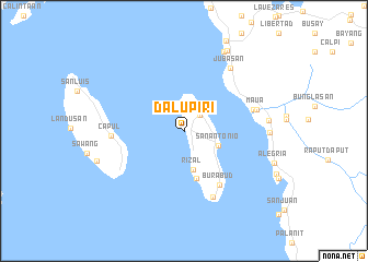
Dalupiri (Northern Samar, Philippines)Dalupiri is a town in the Northern Samar region of Philippines. An overview map of the region around Dalupiri is displayed below.
regional and 3d topo map of Dalupiri, Philippines ::
Dalupiri airports ::
The nearest airport is TAC - Tacloban Daniel Z Romualdez, located 157.6 km south east of Dalupiri.
Other airports nearby include KLO - Kalibo (219.8 km west), BCD - Bacolod (244.2 km south west), ILO - Iloilo (265.3 km south west), Nearby towns ::
Venisitahan (2.3km north east) //
San Antonio (3.8km south east) //
Rizal (4.1km south) //
Manraya (5.0km south) //
Burabud (6.6km south east) //
Pilar (7.4km south east) //
Capul (7.2km west) //
Victoria (7.3km east) //
Maua (7.6km east) //
Jubasan (7.9km north east) //
Taboc (8.5km east) //
Erenas (8.6km east) //
Culab-og (9.0km north east) //
Allen (9.2km north east) //
[all distances 'as the bird flies' and approximate]  Places with similar names to Dalupiri, Philippines ::
Disclaimer :: Information on this page comes without warranty of any kind |
||
|
Where is Dalupiri? Elevation and coordinates ::
Latitude (lat): 12°25'38"N Longitude (lon): 124°14'49"E
Elevation (approx.): 13m (map arrows pan, magnifying glasses zoom) |
||
|
Visiting Dalupiri? Hotel/Accommodation ::
Book a hotel in Dalupiri Travel Guide ::
Buy a travel guide for Philippines rental cars ::
car rental offers GPS waypoint ::
download a GPX waypoint (PoI) of Dalupiri for your GPS receiver
|
||