|
search place name
|
||
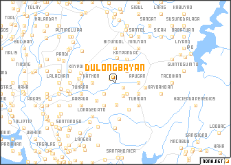
Dulong Bayan (Bulacan, Philippines)Dulong Bayan is a town in the Bulacan region of Philippines. An overview map of the region around Dulong Bayan is displayed below.
regional and 3d topo map of Dulong Bayan, Philippines ::
Dulong Bayan airports ::
The nearest airport is MNL - Manila Ninoy Aquino Intl, located 36.0 km south of Dulong Bayan.
Other airports nearby include BAG - Baguio (176.3 km north), Nearby towns ::
Bulak (1.0km north west) //
Sapang Palay (1.5km south east) //
San Jose del Monte (2.5km south east) //
Sabong (2.6km south west) //
Tungkong Manga (2.6km south east) //
Bayan (2.6km south east) //
Minuyan (2.6km north east) //
Kay Riapay (2.6km north east) //
Muzon (3.6km south) //
Balasing (3.5km north west) //
Katmon (3.6km west) //
Apugan (3.6km east) //
Tigbi (4.0km north) //
Pastol (4.1km south west) //
Sapang Palay (4.0km south east) //
Kay Pandac (4.1km north east) //
San Vicente (4.2km south west) //
Santo Cristo (4.7km east) //
Gaya-gaya (4.9km south east) //
Tubigan (5.2km south east) //
Mangangpico (5.2km south east) //
San Jose (5.4km west) //
San Jose Patag (5.4km west) //
Bituñgol (5.6km north) //
Kay Pombo (5.6km west) //
Tumana (5.7km west) //
Santo Niño (5.7km west) //
Guyong (5.8km west) //
Bagumbong (6.0km south) //
[all distances 'as the bird flies' and approximate]  Places with similar names to Dulong Bayan, Philippines ::
// Dulong Bayan I (PH)
// Dulong Bayan II (PH)
Disclaimer :: Information on this page comes without warranty of any kind |
||
|
Where is Dulong Bayan? Elevation and coordinates ::
Latitude (lat): 14°50'0"N Longitude (lon): 121°2'0"E
Elevation (approx.): 39m (map arrows pan, magnifying glasses zoom) |
||
|
Visiting Dulong Bayan? Hotel/Accommodation ::
Book a hotel in Dulong Bayan Travel Guide ::
Buy a travel guide for Philippines rental cars ::
car rental offers GPS waypoint ::
download a GPX waypoint (PoI) of Dulong Bayan for your GPS receiver
|
||