|
search place name
|
||
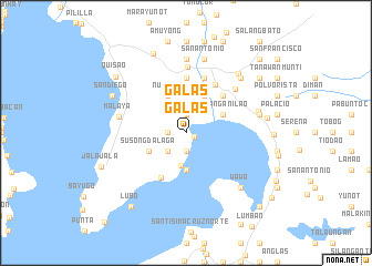
Galas (Laguna, Philippines)Galas is a town in the Laguna region of Philippines. An overview map of the region around Galas is displayed below.
regional and 3d topo map of Galas, Philippines ::
Galas airports ::
The nearest airport is MNL - Manila Ninoy Aquino Intl, located 43.3 km west of Galas.
Other airports nearby include BAG - Baguio (235.8 km north), Nearby towns ::
Azufre (0.9km south east) //
Banilan (1.8km south) //
Kabulusan (1.9km south) //
Galas (1.9km north) //
Dambo (1.9km north) //
Dambo (1.9km north) //
Dorado (1.8km west) //
Basio (2.6km south west) //
Taal (3.3km south) //
Matikiw (3.7km south) //
Susong Dalaga (4.0km south west) //
Wawang Anilao (4.0km north east) //
Dalig (4.1km north east) //
Camagong (4.1km north east) //
Numero (4.1km north west) //
Bagumbong (5.2km south west) //
Nanguma (5.2km north east) //
Maybanga (5.6km north) //
Mabitac (5.7km north east) //
Wilingwiling (5.8km north) //
Siniloan (6.5km north east) //
Paagahan (6.7km north) //
Malaya (6.7km west) //
Macatunao (7.4km north) //
San Antonio (7.6km north) //
Maylatang (7.6km north) //
Hanayan (7.6km north) //
Sulib (7.4km east) //
Labak (7.4km east) //
[all distances 'as the bird flies' and approximate]  Places with similar names to Galas, Philippines ::
Disclaimer :: Information on this page comes without warranty of any kind |
||
|
Where is Galas? Elevation and coordinates ::
Latitude (lat): 14°23'0"N Longitude (lon): 121°24'0"E
Elevation (approx.): 59m (map arrows pan, magnifying glasses zoom) |
||
|
Visiting Galas? Hotel/Accommodation ::
Book a hotel in Galas Travel Guide ::
Buy a travel guide for Philippines rental cars ::
car rental offers GPS waypoint ::
download a GPX waypoint (PoI) of Galas for your GPS receiver
|
||