|
search place name
|
||
Hagna (Southern Leyte, Philippines)Hagna is a town in the Southern Leyte region of Philippines. An overview map of the region around Hagna is displayed below.
regional and 3d topo map of Hagna, Philippines ::

Hagna airports ::
The nearest airport is NOP - Masbate Mactan Cebu Intl, located 110.4 km west of Hagna.
Other airports nearby include TAC - Tacloban Daniel Z Romualdez (111.9 km north), CGY - Ladag Cagayan De Oro (203.4 km south), DGT - Dumaguete (208.9 km south west), Nearby towns ::
Santa Cruz (0.0km north) //
Maojo (0.0km north) //
Iba (1.3km south west) //
Juangon (1.9km north) //
Canumay (1.9km north) //
Timba (2.4km south) //
Ponong (3.2km north) //
Magata (3.7km north) //
San Vicente (3.7km south) //
Tomas Oppus (3.8km north) //
San Isidro (4.1km north east) //
Abgao (4.4km south) //
Matapay (5.6km north) //
Taginoling (5.9km north) //
Malitbog (6.5km south) //
Maslog (6.7km north) //
Tigbawon (7.2km south west) //
San Roque (7.6km south) //
San Jose (8.0km south) //
Basak (8.2km south west) //
San Miguel (8.6km north) //
Tigbauan (8.9km west) //
[all distances 'as the bird flies' and approximate] 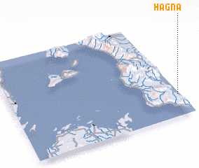 Places with similar names to Hagna, Philippines ::
Disclaimer :: Information on this page comes without warranty of any kind |
||
|
Where is Hagna? Elevation and coordinates ::
Latitude (lat): 10°13'0"N Longitude (lon): 124°59'0"E
Elevation (approx.): -32768m (map arrows pan, magnifying glasses zoom) |
||
|
Visiting Hagna? Hotel/Accommodation ::
Book a hotel in Hagna Travel Guide ::
Buy a travel guide for Philippines rental cars ::
car rental offers GPS waypoint ::
download a GPX waypoint (PoI) of Hagna for your GPS receiver
|
||