|
search place name
|
||
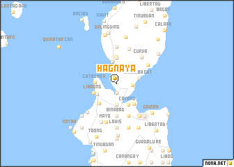
Hagnaya (Cebu, Philippines)Hagnaya is a town in the Cebu region of Philippines. An overview map of the region around Hagnaya is displayed below.
regional and 3d topo map of Hagnaya, Philippines ::
Hagnaya airports ::
The nearest airport is NOP - Masbate Mactan Cebu Intl, located 87.3 km south of Hagnaya.
Other airports nearby include TAC - Tacloban Daniel Z Romualdez (116.7 km east), BCD - Bacolod (124.1 km south west), ILO - Iloilo (161.1 km west), KLO - Kalibo (185.2 km west), Nearby towns ::
Cumbado (1.5km south) //
Lamintak (2.2km north) //
Luy-a (2.3km north) //
Cansanit (2.5km east) //
Calcalan (3.4km south) //
Anonang (3.4km south) //
Catadman (3.5km west) //
Medellin (3.6km north) //
San Remigio (3.6km south west) //
Kanhabagat (3.6km east) //
Cayang (3.8km south east) //
Tindog Sur (4.0km north) //
Caputatan Norte (4.0km north) //
Cawit Sur (4.0km north) //
Libaong (4.0km west) //
Takup (4.0km west) //
Sab-a (4.0km west) //
Punta Isabel (4.0km west) //
Canagahan (4.0km west) //
Gawaygaway (4.0km west) //
Kinawahan (4.0km west) //
Polambato (4.2km south east) //
Sansan (4.3km south west) //
Caputatan (4.3km north) //
Binabag (5.2km south) //
Malingin (5.5km south) //
Argawanon (5.5km south) //
Curva (5.7km north east) //
Tindog Norte (5.7km north east) //
[all distances 'as the bird flies' and approximate]  Places with similar names to Hagnaya, Philippines ::
// Hagnaya (PH)
// Ḩaqqānīyeh (IR)
Disclaimer :: Information on this page comes without warranty of any kind |
||
|
Where is Hagnaya? Elevation and coordinates ::
Latitude (lat): 11°5'49"N Longitude (lon): 123°58'2"E
Elevation (approx.): 7m (map arrows pan, magnifying glasses zoom) |
||
|
Visiting Hagnaya? Hotel/Accommodation ::
Book a hotel in Hagnaya Travel Guide ::
Buy a travel guide for Philippines rental cars ::
car rental offers GPS waypoint ::
download a GPX waypoint (PoI) of Hagnaya for your GPS receiver
|
||