|
search place name
|
||
Iba (Zambales, Philippines)Iba is a town in the Zambales region of Philippines. An overview map of the region around Iba is displayed below.
regional and 3d topo map of Iba, Philippines ::

Iba airports ::
The nearest airport is BAG - Baguio, located 135.0 km north east of Iba.
Other airports nearby include MNL - Manila Ninoy Aquino Intl (143.6 km south east), Nearby towns ::
Lipay (0.8km south east) //
Palañginan (1.0km south east) //
Dirita (1.1km north) //
Santo Rosario (1.8km north west) //
Panibuatan (1.8km north west) //
Santa Barbara (2.1km north east) //
Beneg (2.3km south east) //
Bañgantaliñga (2.4km north west) //
Bancal (2.9km south east) //
Pader (3.4km south east) //
Mambog (4.0km east) //
San Isidro (4.0km east) //
Buen (4.0km east) //
Bajo (5.0km east) //
Amuñgan (5.5km north west) //
Tauogtog (5.7km east) //
San Miguel (5.9km south east) //
Cuagao (6.0km south east) //
Botolan (6.1km south east) //
Danacbuñga (6.3km south east) //
Bañgan-Capayawan (6.3km south east) //
Santiago (6.3km south east) //
Santo Niño (6.7km south east) //
San Agustin (6.9km north west) //
San Andres (6.8km east) //
Batonlapoc (7.2km south east) //
Caturay (7.2km south east) //
Kapayawan (7.2km south east) //
Paitan (7.5km east) //
[all distances 'as the bird flies' and approximate] 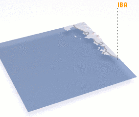 Places with similar names to Iba, Philippines ::
Disclaimer :: Information on this page comes without warranty of any kind |
||
|
Where is Iba? Elevation and coordinates ::
Latitude (lat): 15°19'25"N Longitude (lon): 119°58'49"E
Elevation (approx.): 12m (map arrows pan, magnifying glasses zoom) |
||
|
Visiting Iba? Hotel/Accommodation ::
Book a hotel in Iba Travel Guide ::
Buy a travel guide for Philippines rental cars ::
car rental offers GPS waypoint ::
download a GPX waypoint (PoI) of Iba for your GPS receiver
|
||