|
search place name
|
||
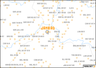
Jambad (Capiz, Philippines)Jambad is a town in the Capiz region of Philippines. An overview map of the region around Jambad is displayed below.
regional and 3d topo map of Jambad, Philippines ::
Jambad airports ::
The nearest airport is KLO - Kalibo, located 53.0 km north west of Jambad.
Other airports nearby include ILO - Iloilo (64.1 km south), BCD - Bacolod (77.2 km south east), SJI - San Jose Antique (97.0 km south west), NOP - Masbate Mactan Cebu Intl (181.1 km south east), Nearby towns ::
Alipasiawan (1.1km north east) //
San Miguel (1.8km west) //
Bayog (2.1km south east) //
Santo Angel (2.6km north) //
Tagulab (2.6km south east) //
Dañgula (2.6km north east) //
Tinaytayan (2.6km north east) //
Santa Teresa (2.6km north west) //
Santa Carmen (2.6km north west) //
Santa Rita (2.6km north west) //
San Rafael (2.6km north west) //
San Jose (2.6km north west) //
Ongol (3.6km east) //
Santo Niño (3.8km north) //
Dumalag (3.8km north west) //
Cubi (4.1km south east) //
Cudingli (4.1km south east) //
Aglalana (4.1km south east) //
Imbarcahan (4.1km south west) //
Salcedo (4.1km south east) //
Concepcion (4.1km west) //
Maludlud (4.6km south west) //
Dumarao (4.7km south east) //
Consolacion (5.2km north) //
San Roque (5.2km north west) //
San Juan (5.4km south) //
Bitoon (5.4km north) //
Malonoy (5.5km east) //
Dolores (5.5km west) //
[all distances 'as the bird flies' and approximate] 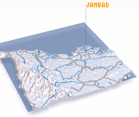 Places with similar names to Jambad, Philippines ::
Disclaimer :: Information on this page comes without warranty of any kind |
||
|
Where is Jambad? Elevation and coordinates ::
Latitude (lat): 11°17'0"N Longitude (lon): 122°39'0"E
Elevation (approx.): 35m (map arrows pan, magnifying glasses zoom) |
||
|
Visiting Jambad? Hotel/Accommodation ::
Book a hotel in Jambad Travel Guide ::
Buy a travel guide for Philippines rental cars ::
car rental offers GPS waypoint ::
download a GPX waypoint (PoI) of Jambad for your GPS receiver
|
||