|
search place name
|
||
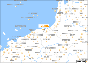
Lajog (Bohol, Philippines)Lajog is a town in the Bohol region of Philippines. An overview map of the region around Lajog is displayed below.
regional and 3d topo map of Lajog, Philippines ::
Lajog airports ::
The nearest airport is NOP - Masbate Mactan Cebu Intl, located 39.2 km north of Lajog.
Other airports nearby include DGT - Dumaguete (103.6 km south west), BCD - Bacolod (140.5 km north west), TAC - Tacloban Daniel Z Romualdez (179.7 km north east), ILO - Iloilo (180.8 km north west), Nearby towns ::
Cangugon (1.1km east) //
Pondol (1.1km south east) //
Tubod (1.1km south east) //
Canogon (1.7km north east) //
Clarin (2.0km north east) //
Buangan (2.6km south east) //
Villanueva (2.7km west) //
Panaytayon (2.7km west) //
Panadtaran (2.7km west) //
Comaang (3.1km north east) //
San Isidro (3.1km north east) //
Canmano (3.1km north east) //
Candajec (3.1km north east) //
Buacao (3.1km north east) //
Bonbon (3.1km north east) //
Talenceras (3.5km south west) //
Bosongon (3.5km south west) //
Tontunan (3.7km south east) //
Macaas (4.1km west) //
Bunakan (4.3km south) //
Cabulihan (4.5km west) //
Pooc Occidental (4.5km west) //
Pooc Oriental (4.5km west) //
Cahayag (4.5km west) //
Obuhan (4.5km west) //
Tinangnan (4.5km west) //
Bacani (4.6km east) //
Kabawan (4.7km east) //
Mataub (4.7km east) //
[all distances 'as the bird flies' and approximate] 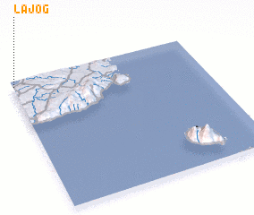 Places with similar names to Lajog, Philippines ::
Disclaimer :: Information on this page comes without warranty of any kind |
||
|
Where is Lajog? Elevation and coordinates ::
Latitude (lat): 9°57'16"N Longitude (lon): 124°0'27"E
Elevation (approx.): 15m (map arrows pan, magnifying glasses zoom) |
||
|
Visiting Lajog? Hotel/Accommodation ::
Book a hotel in Lajog Travel Guide ::
Buy a travel guide for Philippines rental cars ::
car rental offers GPS waypoint ::
download a GPX waypoint (PoI) of Lajog for your GPS receiver
|
||