|
search place name
|
||
Lalao (Siquijor, Philippines)Lalao is a town in the Siquijor region of Philippines. An overview map of the region around Lalao is displayed below.
regional and 3d topo map of Lalao, Philippines ::

Lalao airports ::
The nearest airport is DGT - Dumaguete, located 27.8 km north west of Lalao.
Other airports nearby include NOP - Masbate Mactan Cebu Intl (137.2 km north east), LGP - Legazpi Pagadian (148.2 km south), CGY - Ladag Cagayan De Oro (148.8 km south east), BCD - Bacolod (174.4 km north), Nearby towns ::
San Juan (0.8km south east) //
Sundugan Point (1.2km east) //
Solangon (1.7km north west) //
Maite (2.2km south east) //
Canasagan (2.2km north east) //
Bolos (2.2km north east) //
Paliton (2.5km north west) //
Candura (2.7km east) //
Tubod (2.8km south east) //
Cansayang (3.0km east) //
Dinaguitan (3.5km south east) //
Ilihan (3.6km north east) //
Caitican (3.7km north east) //
Tambisan (4.2km north) //
Tagibo (4.5km south east) //
Napo (5.2km east) //
Cangalwang (5.2km north) //
Dinagkita (5.2km south east) //
Lambojon (5.2km east) //
San Antonio (5.6km east) //
Sam-ang (5.7km north) //
Canal (5.7km north) //
Sabang (5.7km north) //
Caticugan (5.7km north) //
Caipilan (5.7km north) //
Dumanhog (5.7km north) //
Pañgi (5.7km north) //
Cangadieng (5.7km north) //
Pili (5.7km north) //
[all distances 'as the bird flies' and approximate] 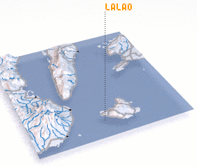 Places with similar names to Lalao, Philippines ::
Disclaimer :: Information on this page comes without warranty of any kind |
||
|
Where is Lalao? Elevation and coordinates ::
Latitude (lat): 9°9'59"N Longitude (lon): 123°29'21"E
Elevation (approx.): 25m (map arrows pan, magnifying glasses zoom) |
||
|
Visiting Lalao? Hotel/Accommodation ::
Book a hotel in Lalao Travel Guide ::
Buy a travel guide for Philippines rental cars ::
car rental offers GPS waypoint ::
download a GPX waypoint (PoI) of Lalao for your GPS receiver
|
||