|
search place name
|
||
Langam (Davao del Norte, Philippines)Langam is a town in the Davao del Norte region of Philippines. An overview map of the region around Langam is displayed below.
regional and 3d topo map of Langam, Philippines ::

Langam airports ::
The nearest airport is CGY - Ladag Cagayan De Oro, located 180.4 km north west of Langam.
Other airports nearby include CEB - Cebu Cotabato (182.3 km west), Nearby towns ::
Maco (1.5km north east) //
Hijo (1.8km west) //
Lampinigan (1.9km south) //
Binuangan (1.9km north) //
Mabini (4.3km south) //
Madaum (4.5km north west) //
Cuambog (4.6km south) //
Apokon (6.6km north west) //
Pindasan (7.2km south) //
Tagnanan (7.4km south) //
Kopia (7.9km south) //
Libuganon (7.9km west) //
[all distances 'as the bird flies' and approximate] 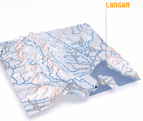 Places with similar names to Langam, Philippines ::
Disclaimer :: Information on this page comes without warranty of any kind |
||
|
Where is Langam? Elevation and coordinates ::
Latitude (lat): 7°21'0"N Longitude (lon): 125°51'0"E
Elevation (approx.): -32768m (map arrows pan, magnifying glasses zoom) |
||
|
Visiting Langam? Hotel/Accommodation ::
Book a hotel in Langam Travel Guide ::
Buy a travel guide for Philippines rental cars ::
car rental offers GPS waypoint ::
download a GPX waypoint (PoI) of Langam for your GPS receiver
|
||