|
search place name
|
||
Libmanan (Camarines Sur, Philippines)Libmanan is a town in the Camarines Sur region of Philippines. An overview map of the region around Libmanan is displayed below.
regional and 3d topo map of Libmanan, Philippines ::
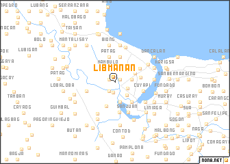
Nearby towns ::
Bigaho Sur (0.9km north east) //
Paolbo (0.9km north east) //
Mandacanan (0.9km north east) //
Uson-Padlos (0.9km north east) //
Handong (0.9km north east) //
Tampuhan (0.9km north east) //
Santa Salud (0.9km north east) //
Inalahan (0.9km north east) //
La Purisima (0.9km north east) //
San Lucas (0.9km north east) //
Tinanquian (0.9km north east) //
Aslong (0.9km north east) //
Bagadion (0.9km north east) //
Awayan (0.9km north east) //
Pagoring Nuevo (0.9km north east) //
Del Carmen (0.9km north east) //
Ibong-Potot (0.9km north east) //
Tarum (0.9km north east) //
Labao (0.9km north east) //
Sigamut (1.1km north west) //
Taban (1.1km north west) //
San Juan (1.1km north west) //
Plancha (1.7km south) //
Polot (1.7km south west) //
Concepcion (2.2km south east) //
Candato (2.4km north) //
Bigaho Norte (2.4km north) //
Luawan (2.5km north west) //
Palagnon (2.5km north west) //
[all distances 'as the bird flies' and approximate] 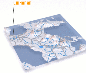 Places with similar names to Libmanan, Philippines ::
// Lubomnini (ZA)
Disclaimer :: Information on this page comes without warranty of any kind |
||
|
Where is Libmanan? Elevation and coordinates ::
Latitude (lat): 13°41'46"N Longitude (lon): 123°3'33"E
Elevation (approx.): 6m (map arrows pan, magnifying glasses zoom) |
||
|
Visiting Libmanan? Hotel/Accommodation ::
Book a hotel in Libmanan Travel Guide ::
Buy a travel guide for Philippines rental cars ::
car rental offers GPS waypoint ::
download a GPX waypoint (PoI) of Libmanan for your GPS receiver
|
||