|
search place name
|
||
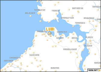
Lubi (Leyte, Philippines)Lubi is a town in the Leyte region of Philippines. An overview map of the region around Lubi is displayed below.
regional and 3d topo map of Lubi, Philippines ::
Lubi airports ::
The nearest airport is TAC - Tacloban Daniel Z Romualdez, located 27.3 km south east of Lubi.
Other airports nearby include NOP - Masbate Mactan Cebu Intl (156.4 km south west), BCD - Bacolod (228.3 km west), Nearby towns ::
Tabaltabal (0.0km north) //
Nababuy (0.0km north) //
Kanapuyo (0.1km south east) //
Dalakit (1.0km north west) //
Ubayan (1.8km east) //
Busay (1.8km west) //
Jagna (1.8km west) //
Tabang (1.9km south west) //
Babatngon (2.4km west) //
Binuntuan (2.7km north east) //
Magsaigad (2.9km west) //
Kanjaloy (3.6km east) //
Rizal (3.8km south east) //
Malabago (3.9km south) //
Dongon (4.1km south east) //
Lukay (4.1km south east) //
Samputan (4.3km east) //
Igangigang (5.2km north) //
Kabatong (5.2km west) //
Kalangawan (5.4km west) //
Nabungkagan (6.3km west) //
Cabongaan (6.5km north) //
Malibago (6.4km east) //
Navatas Buti (6.6km north west) //
Bakong (6.6km west) //
Tulaan (6.8km south west) //
Santa Cruz (7.2km south west) //
Habuaya (7.3km north west) //
Nagaasan (7.8km east) //
[all distances 'as the bird flies' and approximate] 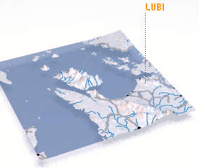 Places with similar names to Lubi, Philippines ::
Disclaimer :: Information on this page comes without warranty of any kind |
||
|
Where is Lubi? Elevation and coordinates ::
Latitude (lat): 11°25'0"N Longitude (lon): 124°52'0"E
Elevation (approx.): -32768m (map arrows pan, magnifying glasses zoom) |
||
|
Visiting Lubi? Hotel/Accommodation ::
Book a hotel in Lubi Travel Guide ::
Buy a travel guide for Philippines rental cars ::
car rental offers GPS waypoint ::
download a GPX waypoint (PoI) of Lubi for your GPS receiver
|
||