|
search place name
|
||
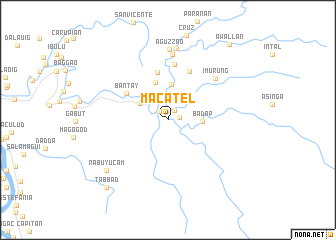
Macatel (Cagayan, Philippines)Macatel is a town in the Cagayan region of Philippines. An overview map of the region around Macatel is displayed below.
regional and 3d topo map of Macatel, Philippines ::
Macatel airports ::
The nearest airport is BAG - Baguio, located 214.1 km south west of Macatel.
Nearby towns ::
Dabbac (1.2km north east) //
Tungal (1.2km east) //
Ajjao (1.3km north west) //
San Jose (2.3km north) //
Battuguit (2.4km north west) //
Nangalinan (2.9km north) //
Tetay (2.9km north) //
Bitag (3.5km north west) //
Badap (3.6km east) //
Santos (4.0km north) //
Bantay (4.4km north) //
Annayatan (5.5km north) //
Bantay (5.3km north west) //
Bacagan (5.8km north) //
Dares (6.2km north) //
Imurung (6.8km north east) //
Pares (7.3km north) //
Aguzzao (7.9km north) //
Lasilat (8.1km north) //
Nabuyucam (8.7km south west) //
Tabbad (10.0km south west) //
Awallan (10.6km north east) //
[all distances 'as the bird flies' and approximate] 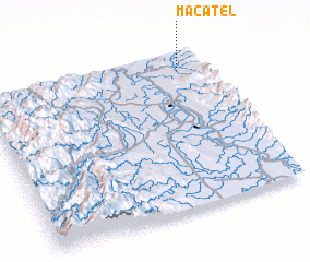 Places with similar names to Macatel, Philippines ::
Disclaimer :: Information on this page comes without warranty of any kind |
||
|
Where is Macatel? Elevation and coordinates ::
Latitude (lat): 17°53'4"N Longitude (lon): 121°52'43"E
Elevation (approx.): 27m (map arrows pan, magnifying glasses zoom) |
||
|
Visiting Macatel? Hotel/Accommodation ::
Book a hotel in Macatel Travel Guide ::
Buy a travel guide for Philippines rental cars ::
car rental offers GPS waypoint ::
download a GPX waypoint (PoI) of Macatel for your GPS receiver
|
||