|
search place name
|
||
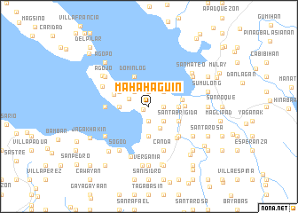
Mahahaguin (Quezon, Philippines)Mahahaguin is a town in the Quezon region of Philippines. An overview map of the region around Mahahaguin is displayed below.
regional and 3d topo map of Mahahaguin, Philippines ::
Mahahaguin airports ::
The nearest airport is MNL - Manila Ninoy Aquino Intl, located 146.5 km north west of Mahahaguin.
Nearby towns ::
Hondagua (0.8km south west) //
Patihan (1.9km north) //
Roma (1.9km south) //
Pamalang (1.9km north) //
San Juan (1.8km east) //
San Diego (2.6km north east) //
Guitis (2.6km south east) //
Lagundi (2.6km north west) //
Santo Domingo (2.6km north west) //
Lourdes (2.6km west) //
Manhulugin (2.9km north west) //
Bigajo (3.0km south east) //
Kabuluan (3.6km east) //
Binutas (3.6km east) //
Kumalodkod (3.6km east) //
Kigtan (3.6km east) //
Catangtang (3.6km east) //
Bagong Silang (3.6km east) //
Bigaan (3.6km east) //
Mabini (3.6km east) //
Rizal (3.6km east) //
Guinosayan (3.6km east) //
Kinalin (3.6km east) //
Panlillo (3.6km west) //
Anas (3.6km east) //
Biyan (3.6km east) //
Inalusan (3.6km east) //
Tikiwan (3.6km east) //
Hugos (3.6km east) //
[all distances 'as the bird flies' and approximate] 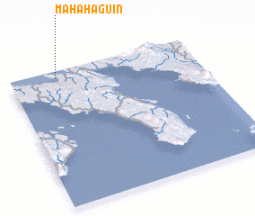 Places with similar names to Mahahaguin, Philippines :: Disclaimer :: Information on this page comes without warranty of any kind |
||
|
Where is Mahahaguin? Elevation and coordinates ::
Latitude (lat): 13°57'0"N Longitude (lon): 122°15'0"E
Elevation (approx.): 30m (map arrows pan, magnifying glasses zoom) |
||
|
Visiting Mahahaguin? Hotel/Accommodation ::
Book a hotel in Mahahaguin Travel Guide ::
Buy a travel guide for Philippines rental cars ::
car rental offers GPS waypoint ::
download a GPX waypoint (PoI) of Mahahaguin for your GPS receiver
|
||