|
search place name
|
||
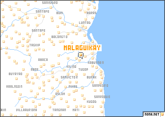
Malaguikay (Leyte, Philippines)Malaguikay is a town in the Leyte region of Philippines. An overview map of the region around Malaguikay is displayed below.
regional and 3d topo map of Malaguikay, Philippines ::
Malaguikay airports ::
The nearest airport is TAC - Tacloban Daniel Z Romualdez, located 14.6 km north of Malaguikay.
Other airports nearby include NOP - Masbate Mactan Cebu Intl (141.6 km south west), DGT - Dumaguete (269.5 km south west), Nearby towns ::
Pago (0.8km south west) //
San Miguel (0.8km north east) //
Malbog (1.4km west) //
Arado (2.0km north) //
Guingawan (2.0km north) //
Kaboynan (2.0km north) //
Guindagan (2.0km north) //
Tanghas (2.2km east) //
Tolosa (2.2km east) //
Tanauan (2.4km north east) //
San Pedro (2.9km south east) //
Limbujan (3.0km north east) //
Talolora (3.0km north east) //
Salvador (3.0km north east) //
Haclagan (3.0km north east) //
Mohon (3.0km north east) //
Santa Elena (3.2km west) //
San Vicente (3.6km south) //
Tugop (3.6km south) //
Camire (3.7km north) //
Kabuynan (3.7km south east) //
San Antonio (3.8km north west) //
Kiling (3.8km south west) //
Cogon (3.9km south) //
Limbuhan (4.3km south east) //
Balocawe (4.3km north west) //
Camaire (4.4km north east) //
Santa Cruz (4.6km north west) //
Ariuan (4.8km south west) //
[all distances 'as the bird flies' and approximate]  Places with similar names to Malaguikay, Philippines ::
// Mialkougou (CM)
// Mèlako-auk (MM)
// Mǝlcǝk (AZ)
// Milokokkiá (GR)
// Melgaço (PT)
// Malakówka (PL)
// Mały Kack (PL)
// Miłkówko (PL)
// Mallkeq (AL)
// Mallkuç (AL)
Disclaimer :: Information on this page comes without warranty of any kind |
||
|
Where is Malaguikay? Elevation and coordinates ::
Latitude (lat): 11°5'57"N Longitude (lon): 124°59'46"E
Elevation (approx.): 9m (map arrows pan, magnifying glasses zoom) |
||
|
Visiting Malaguikay? Hotel/Accommodation ::
Book a hotel in Malaguikay Travel Guide ::
Buy a travel guide for Philippines rental cars ::
car rental offers GPS waypoint ::
download a GPX waypoint (PoI) of Malaguikay for your GPS receiver
|
||