|
search place name
|
||
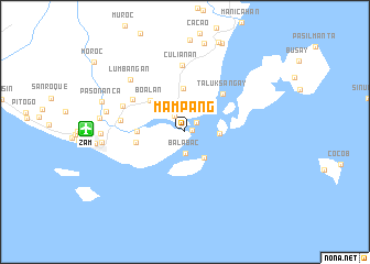
Mampang (Zamboanga, Philippines)Mampang is a town in the Zamboanga region of Philippines. An overview map of the region around Mampang is displayed below.
regional and 3d topo map of Mampang, Philippines ::
Mampang airports ::
The nearest airport is ZAM - Zamboanga Intl, located 9.9 km west of Mampang.
Other airports nearby include LGP - Legazpi Pagadian (176.0 km north east), Nearby towns ::
Masinloc (0.7km east) //
Vilanvilan (1.5km north east) //
Mululuan (1.9km north west) //
Balabac (2.2km south) //
Lumbayan (3.2km north) //
Tigtabon (3.3km south east) //
Talabaan (3.5km north east) //
Pangapuyan (3.5km east) //
Mercedes (4.4km north) //
Boalan (4.7km north west) //
Tugbungan (4.8km west) //
Talon-Talon (5.0km west) //
Taluksangay (5.4km north east) //
Divisoria (6.2km north west) //
Guiwan (6.6km west) //
Culianan (6.8km north) //
Putik (6.8km north west) //
Lumbangan (7.6km north west) //
Tumaga (8.1km west) //
Zamboanga (8.4km west) //
Canelar (8.5km west) //
Santa Maria (8.7km west) //
Pasonanca (9.0km west) //
[all distances 'as the bird flies' and approximate]  Places with similar names to Mampang, Philippines ::
Disclaimer :: Information on this page comes without warranty of any kind |
||
|
Where is Mampang? Elevation and coordinates ::
Latitude (lat): 6°55'10"N Longitude (lon): 122°8'58"E
Elevation (approx.): 5m (map arrows pan, magnifying glasses zoom) |
||
|
Visiting Mampang? Hotel/Accommodation ::
Book a hotel in Mampang Travel Guide ::
Buy a travel guide for Philippines rental cars ::
car rental offers GPS waypoint ::
download a GPX waypoint (PoI) of Mampang for your GPS receiver
|
||