|
search place name
|
||
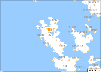
Paet (Samar, Philippines)Paet is a town in the Samar region of Philippines. An overview map of the region around Paet is displayed below.
regional and 3d topo map of Paet, Philippines ::
Paet airports ::
The nearest airport is TAC - Tacloban Daniel Z Romualdez, located 58.3 km south east of Paet.
Other airports nearby include NOP - Masbate Mactan Cebu Intl (173.8 km south west), BCD - Bacolod (230.0 km south west), Nearby towns ::
Irawarne (0.9km south east) //
Bunanun (1.4km north) //
Tugas (1.8km east) //
Hacopon (2.4km south west) //
Astorga (2.6km south east) //
Parasan (2.7km north) //
Birauen (3.4km south) //
Molung (3.5km west) //
San Jose (3.7km north west) //
Sogod (3.9km south) //
Soong (4.0km south east) //
Obo (4.3km south) //
Sebunganan (4.8km south east) //
Rizal (5.1km north) //
Malara (5.5km south) //
Mayaboy (6.5km south) //
Daram (6.6km south east) //
Tinaogan (8.4km east) //
Manduyucan (8.6km south) //
San Isidro (8.4km east) //
Saugan (9.7km south east) //
Manduyucan (10.0km south east) //
Mungolbungol (10.0km south east) //
[all distances 'as the bird flies' and approximate]  Places with similar names to Paet, Philippines ::
Disclaimer :: Information on this page comes without warranty of any kind |
||
|
Where is Paet? Elevation and coordinates ::
Latitude (lat): 11°40'48"N Longitude (lon): 124°45'16"E
Elevation (approx.): 12m (map arrows pan, magnifying glasses zoom) |
||
|
Visiting Paet? Hotel/Accommodation ::
Book a hotel in Paet Travel Guide ::
Buy a travel guide for Philippines rental cars ::
car rental offers GPS waypoint ::
download a GPX waypoint (PoI) of Paet for your GPS receiver
|
||