|
search place name
|
||
Palakipak (Pangasinan, Philippines)Palakipak is a town in the Pangasinan region of Philippines. An overview map of the region around Palakipak is displayed below.
regional and 3d topo map of Palakipak, Philippines ::

Palakipak airports ::
The nearest airport is BAG - Baguio, located 56.3 km north of Palakipak.
Other airports nearby include MNL - Manila Ninoy Aquino Intl (156.4 km south), Nearby towns ::
Nancoralan (0.0km north) //
Padaanan (1.8km east) //
Coliling (1.9km south) //
Guiling (1.9km south) //
Cabalaoangan (2.1km north east) //
Camangaan (2.1km south east) //
Salcedo (2.1km south west) //
Cabalaoangan Norte (2.6km north east) //
Carmen (2.6km north west) //
Salvacion (2.6km north west) //
Tumana (2.6km north west) //
Rabago (2.6km south east) //
San Agustin (3.1km south) //
Rosales (3.5km north east) //
Limansangan (3.6km east) //
San Tomas (3.7km west) //
Carmay (4.1km north east) //
Batikbatik (4.1km north east) //
San Pedro (4.0km north east) //
San Angel (4.0km south east) //
La Luna (4.0km north west) //
San Marcos (4.0km north west) //
Santo Niño (4.0km north west) //
Pañgaoan (4.1km south east) //
Acop (4.2km east) //
San Agustin (4.4km south east) //
Mangandingay (4.9km south) //
Villasis (4.9km north west) //
San José (4.9km west) //
[all distances 'as the bird flies' and approximate] 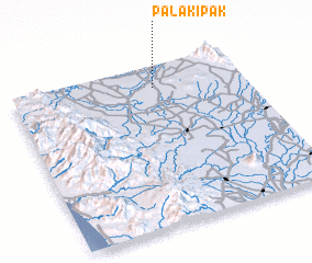
Disclaimer :: Information on this page comes without warranty of any kind |
||
|
Where is Palakipak? Elevation and coordinates ::
Latitude (lat): 15°52'0"N Longitude (lon): 120°37'0"E
Elevation (approx.): 32m (map arrows pan, magnifying glasses zoom) |
||
|
Visiting Palakipak? Hotel/Accommodation ::
Book a hotel in Palakipak Travel Guide ::
Buy a travel guide for Philippines rental cars ::
car rental offers GPS waypoint ::
download a GPX waypoint (PoI) of Palakipak for your GPS receiver
|
||