|
search place name
|
||
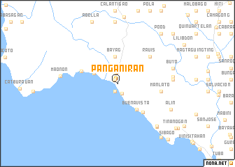
Panganiran (Albay, Philippines)Panganiran is a town in the Albay region of Philippines. An overview map of the region around Panganiran is displayed below.
regional and 3d topo map of Panganiran, Philippines ::
Panganiran airports ::
The nearest airport is KLO - Kalibo, located 189.7 km south west of Panganiran.
Other airports nearby include TAC - Tacloban Daniel Z Romualdez (262.7 km south east), Nearby towns ::
Nalagbalac (0.7km north west) //
Pio Duran (0.7km north west) //
Balacbalac (1.3km south) //
Boton (1.7km north) //
Malidong (1.8km south east) //
Magradongdong (3.9km north west) //
Bayag (4.3km north) //
Buenavista (5.1km south east) //
Basicao (5.9km west) //
Santa Cruz (6.1km south east) //
Rauis (6.6km north east) //
Manlato (6.9km east) //
Manilao (8.7km east) //
Macabulian (8.7km east) //
Estrella (8.7km east) //
Buyo (9.0km east) //
San Ramon (9.3km south east) //
San Remo (9.3km south east) //
Alin (9.3km south east) //
Pood (10.5km north east) //
San Rafael (11.0km south east) //
Gumian (11.8km north east) //
[all distances 'as the bird flies' and approximate] 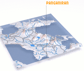 Places with similar names to Panganiran, Philippines ::
// Panganuran (PH)
// Panganuran (PH)
Disclaimer :: Information on this page comes without warranty of any kind |
||
|
Where is Panganiran? Elevation and coordinates ::
Latitude (lat): 13°1'41"N Longitude (lon): 123°27'13"E
Elevation (approx.): 4m (map arrows pan, magnifying glasses zoom) |
||
|
Visiting Panganiran? Hotel/Accommodation ::
Book a hotel in Panganiran Travel Guide ::
Buy a travel guide for Philippines rental cars ::
car rental offers GPS waypoint ::
download a GPX waypoint (PoI) of Panganiran for your GPS receiver
|
||