|
search place name
|
||
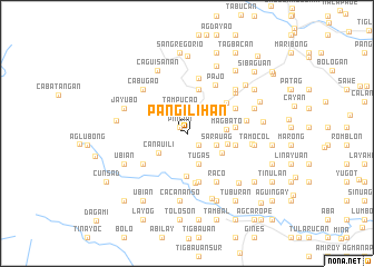
Pañgilihan (Iloilo, Philippines)Pañgilihan is a town in the Iloilo region of Philippines. An overview map of the region around Pañgilihan is displayed below.
regional and 3d topo map of Pañgilihan, Philippines ::
Pañgilihan airports ::
The nearest airport is ILO - Iloilo, located 36.6 km south of Pañgilihan.
Other airports nearby include SJI - San Jose Antique (62.4 km south west), BCD - Bacolod (68.4 km south east), KLO - Kalibo (72.4 km north), NOP - Masbate Mactan Cebu Intl (186.3 km south east), Nearby towns ::
Pingan (1.0km north west) //
Dabong (1.6km south east) //
Hipgos (2.6km north) //
Tampucao (2.6km north) //
Mapanag (2.7km north east) //
Misi (2.8km north) //
Botong (3.2km east) //
Sarauag (3.2km east) //
Tugas (3.3km south) //
Mañacabac (3.3km south) //
Canauili (3.4km south west) //
Sagcup (3.9km north east) //
Bonbon (3.9km north east) //
Balaguiao (3.9km north east) //
Manaripay (3.9km north east) //
Jorog (3.9km north east) //
Ualang (3.9km north east) //
Burirao (3.9km north east) //
Lumanay (3.9km north east) //
Bontoc (3.9km north east) //
Madarag (3.9km north east) //
Bon-od (3.9km north east) //
Manaulan (3.9km north east) //
Supoc (3.9km north east) //
Magbato (3.9km east) //
Patongpatong (4.0km south east) //
Abañgay (4.1km east) //
Calmay (4.3km south) //
Pasig (4.5km north) //
[all distances 'as the bird flies' and approximate]  Places with similar names to Pañgilihan, Philippines :: Disclaimer :: Information on this page comes without warranty of any kind |
||
|
Where is Pañgilihan? Elevation and coordinates ::
Latitude (lat): 11°1'39"N Longitude (lon): 122°26'23"E
Elevation (approx.): 197m (map arrows pan, magnifying glasses zoom) |
||
|
Visiting Pañgilihan? Hotel/Accommodation ::
Book a hotel in Pañgilihan Travel Guide ::
Buy a travel guide for Philippines rental cars ::
car rental offers GPS waypoint ::
download a GPX waypoint (PoI) of Pañgilihan for your GPS receiver
|
||