|
search place name
|
||
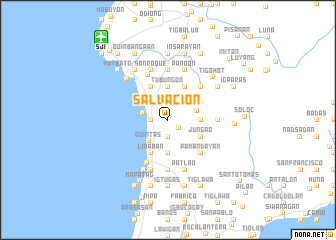
Salvacion (Antique, Philippines)Salvacion is a town in the Antique region of Philippines. An overview map of the region around Salvacion is displayed below.
regional and 3d topo map of Salvacion, Philippines ::
Salvacion airports ::
The nearest airport is SJI - San Jose Antique, located 11.7 km north west of Salvacion.
Other airports nearby include ILO - Iloilo (59.7 km east), BCD - Bacolod (101.8 km east), KLO - Kalibo (117.6 km north), DGT - Dumaguete (206.4 km south east), Nearby towns ::
Panoon (1.6km south east) //
Igbalogo (1.9km south) //
Linaban (1.9km south) //
Ualog (1.9km south) //
Cubay (1.9km north) //
Caridad (1.8km west) //
Dancalan (1.8km west) //
Calala (2.9km west) //
Guintas (3.2km south west) //
Bongabongan (3.3km east) //
Cabaguan (3.6km east) //
Badiangan (3.6km east) //
Budiong (3.7km south) //
Tubungon (3.7km north) //
Hamtic (3.7km north west) //
Jungao (4.1km south east) //
Ayutay (4.1km north east) //
Danauan (4.1km north east) //
Linaban (4.1km south west) //
Bigaa (4.1km north west) //
Nalijauan (4.1km north east) //
Pamandayan (5.2km south east) //
Cacao (5.2km south east) //
Igbobolo (5.2km north east) //
Igtara (5.2km north east) //
Villavert-Jimenez (5.4km south west) //
Piape (5.4km north west) //
Cabagangan (5.5km east) //
Apdo (5.6km south) //
[all distances 'as the bird flies' and approximate] 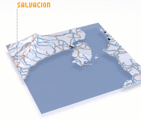 Places with similar names to Salvacion, Philippines ::
Disclaimer :: Information on this page comes without warranty of any kind |
||
|
Where is Salvacion? Elevation and coordinates ::
Latitude (lat): 10°41'0"N Longitude (lon): 122°0'0"E
Elevation (approx.): 71m (map arrows pan, magnifying glasses zoom) |
||
|
Visiting Salvacion? Hotel/Accommodation ::
Book a hotel in Salvacion Travel Guide ::
Buy a travel guide for Philippines rental cars ::
car rental offers GPS waypoint ::
download a GPX waypoint (PoI) of Salvacion for your GPS receiver
|
||