|
search place name
|
||
San Celestino (Lipa, Philippines)San Celestino is a town in the Lipa region of Philippines. An overview map of the region around San Celestino is displayed below.
regional and 3d topo map of San Celestino, Philippines ::

San Celestino airports ::
The nearest airport is MNL - Manila Ninoy Aquino Intl, located 68.6 km north of San Celestino.
Nearby towns ::
San Benito (3.0km north west) //
San Francisco (3.3km south) //
Santo Toribio (3.4km east) //
Tipacan (4.1km west) //
Pansol (4.4km south) //
Nuynuyin (4.3km south east) //
Labac (4.5km south west) //
Bawi (4.7km south) //
Sapac (4.7km north west) //
Sambat (4.8km south west) //
Banaba (4.8km south west) //
Tangob (5.0km north west) //
Rosario (5.2km south west) //
Santo Niño (5.1km north west) //
Pinagcawitan (5.2km south west) //
Niing (5.1km east) //
Bukal (5.5km east) //
Tañgob (5.7km south east) //
Padre Garcia (5.7km south west) //
Talisay (6.0km north west) //
Antipolo (5.9km west) //
San Felipe (6.1km south west) //
Patay (6.3km west) //
Bogonong (6.3km north west) //
Muntingpulo (6.3km north west) //
Payapa (6.6km south) //
Balete (6.6km south west) //
Bungahan (6.7km south) //
Castillo (6.6km south east) //
[all distances 'as the bird flies' and approximate] 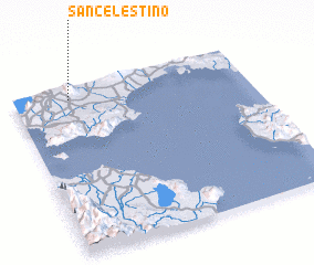 Places with similar names to San Celestino, Philippines ::
// San Celestino (CU)
Disclaimer :: Information on this page comes without warranty of any kind |
||
|
Where is San Celestino? Elevation and coordinates ::
Latitude (lat): 13°55'32"N Longitude (lon): 121°14'11"E
Elevation (approx.): 211m (map arrows pan, magnifying glasses zoom) |
||
|
Visiting San Celestino? Hotel/Accommodation ::
Book a hotel in San Celestino Travel Guide ::
Buy a travel guide for Philippines rental cars ::
car rental offers GPS waypoint ::
download a GPX waypoint (PoI) of San Celestino for your GPS receiver
|
||