|
search place name
|
||
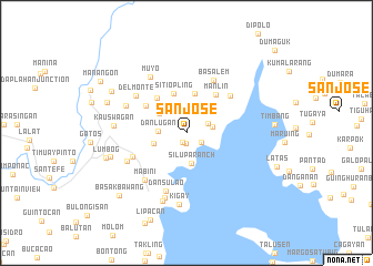
San Jose (Zamboanga del Sur, Philippines)San Jose is a town in the Zamboanga del Sur region of Philippines. An overview map of the region around San Jose is displayed below.
regional and 3d topo map of San Jose, Philippines ::
San Jose airports ::
The nearest airport is LGP - Legazpi Pagadian, located 47.1 km east of San Jose.
Other airports nearby include ZAM - Zamboanga Intl (138.9 km south west), CEB - Cebu Cotabato (140.3 km south east), DGT - Dumaguete (183.6 km north), CGY - Ladag Cagayan De Oro (189.4 km north east), Nearby towns ::
Bawang (1.1km south) //
Silupa (1.1km south) //
Compostela (1.1km north) //
Palug (1.8km south east) //
Lantawan (2.3km north east) //
Gusem (2.7km east) //
Danlugan (2.8km west) //
Silupa Ranch (3.1km south) //
Mabuhay (3.4km north west) //
Del Pilar (3.4km west) //
Buug (4.0km north) //
Sitio Pling (4.2km north) //
Maganay (4.5km north west) //
Manlin (4.8km north east) //
Diplahan (4.9km north west) //
Gumikita (5.8km north east) //
La Dicha (5.9km south west) //
Basalem (5.9km north east) //
Dansulao (6.2km south) //
Del Monte (6.2km north west) //
Mabini (6.3km south west) //
Talon (6.5km south west) //
Butong (6.5km south west) //
Santa Cruz (6.6km north west) //
Muyo (6.6km north west) //
Malangai (6.9km south) //
Kigay (7.3km south) //
Malangas (7.3km south) //
Kauswagan (7.3km west) //
[all distances 'as the bird flies' and approximate]  Places with similar names to San Jose, Philippines ::
Disclaimer :: Information on this page comes without warranty of any kind |
||
|
Where is San Jose? Elevation and coordinates ::
Latitude (lat): 7°41'32"N Longitude (lon): 123°3'12"E
Elevation (approx.): 95m (map arrows pan, magnifying glasses zoom) |
||
|
Visiting San Jose? Hotel/Accommodation ::
Book a hotel in San Jose Travel Guide ::
Buy a travel guide for Philippines rental cars ::
car rental offers GPS waypoint ::
download a GPX waypoint (PoI) of San Jose for your GPS receiver
|
||