|
search place name
|
||
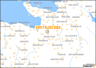
Santa Jacaba (Quezon, Philippines)Santa Jacaba is a town in the Quezon region of Philippines. An overview map of the region around Santa Jacaba is displayed below.
regional and 3d topo map of Santa Jacaba, Philippines ::
Santa Jacaba airports ::
The nearest airport is MNL - Manila Ninoy Aquino Intl, located 151.4 km north west of Santa Jacaba.
Nearby towns ::
Sumalang (0.0km north) //
Bigajo (0.0km north) //
Bocboc (0.0km north) //
Lopez (0.3km north west) //
Piñafrancia (1.9km south) //
Bebito (1.9km north) //
Canda (1.9km north) //
Guihay (1.9km north) //
Villa Nacaub (1.8km west) //
Mandog (1.8km west) //
Lourdes (1.8km west) //
Matinik (1.8km west) //
San Miguel (1.8km west) //
Danlagan (1.8km west) //
Jayopag (1.8km west) //
General Vera (1.8km west) //
Tanag Ibaba (1.8km west) //
Buenavista (1.8km west) //
Manguisian (1.8km west) //
Magallanes (1.8km west) //
Vega Flor (1.8km west) //
Vergania (1.8km west) //
Guinuañgan (1.8km west) //
Jongo Ibaba (1.8km west) //
Del Pilar (1.8km west) //
San Antonio (2.2km south) //
Tanboo (2.6km south east) //
San Isidro (2.6km south west) //
Inobacan (2.6km south west) //
[all distances 'as the bird flies' and approximate]  Places with similar names to Santa Jacaba, Philippines ::
// Saint Jacob (US)
Disclaimer :: Information on this page comes without warranty of any kind |
||
|
Where is Santa Jacaba? Elevation and coordinates ::
Latitude (lat): 13°53'0"N Longitude (lon): 122°16'0"E
Elevation (approx.): 11m (map arrows pan, magnifying glasses zoom) |
||
|
Visiting Santa Jacaba? Hotel/Accommodation ::
Book a hotel in Santa Jacaba Travel Guide ::
Buy a travel guide for Philippines rental cars ::
car rental offers GPS waypoint ::
download a GPX waypoint (PoI) of Santa Jacaba for your GPS receiver
|
||