|
search place name
|
||
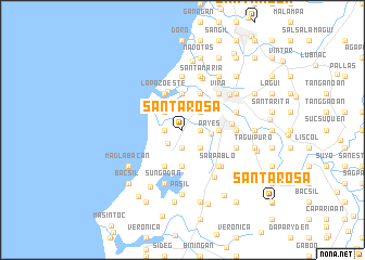
Santa Rosa (Ilocos Norte, Philippines)Santa Rosa is a town in the Ilocos Norte region of Philippines. An overview map of the region around Santa Rosa is displayed below.
regional and 3d topo map of Santa Rosa, Philippines ::
Santa Rosa airports ::
The nearest airport is BAG - Baguio, located 198.4 km south of Santa Rosa.
Nearby towns ::
Raraburan (1.8km east) //
Gabu Norte (1.8km west) //
Mangñgato (1.8km west) //
Balacad (1.9km south) //
Caataban (1.9km south) //
Araniw (1.8km west) //
Calayab (2.0km south west) //
Cabunga-an (2.1km north) //
Pauong (2.6km north east) //
Tasod (2.6km north west) //
Nangalisan (2.6km north east) //
Darayday (2.6km north east) //
Bengcag (2.6km north east) //
Capalngan (2.6km north east) //
Samac (2.6km south east) //
Payes (2.9km east) //
Gabu Sur (3.5km north west) //
Daurao (3.7km north) //
Bugnay (3.5km east) //
Bengcag (3.5km east) //
Nang-guyudan (3.7km south) //
Tangib (4.1km north east) //
Sagneb (4.1km north east) //
Lusong (4.1km north east) //
La Paz Oeste (4.1km north west) //
Cavit (4.1km north west) //
Balatong (4.1km south west) //
La Paz Este (4.2km north) //
San Nicolas (4.9km east) //
[all distances 'as the bird flies' and approximate]  Places with similar names to Santa Rosa, Philippines ::
// Sania Torres (MA)
// Santa Rosa (BR)
// Santa Rosa (BR)
// Santa Rosa (BR)
// Santa Rosa (BR)
// Santa Rosa (BR)
// Santa Rosa (BR)
// Santa Rosa (BR)
// Santa Rosa (BR)
// Santa Rosa (BR)
Disclaimer :: Information on this page comes without warranty of any kind |
||
|
Where is Santa Rosa? Elevation and coordinates ::
Latitude (lat): 18°10'0"N Longitude (lon): 120°33'0"E
Elevation (approx.): 5m (map arrows pan, magnifying glasses zoom) |
||
|
Visiting Santa Rosa? Hotel/Accommodation ::
Book a hotel in Santa Rosa Travel Guide ::
Buy a travel guide for Philippines rental cars ::
car rental offers GPS waypoint ::
download a GPX waypoint (PoI) of Santa Rosa for your GPS receiver
|
||