|
search place name
|
||
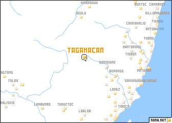
Tagamacan (Philippines)Tagamacan is a town in Philippines. An overview map of the region around Tagamacan is displayed below.
regional and 3d topo map of Tagamacan, Philippines ::
Tagamacan airports ::
The nearest airport is BCD - Bacolod, located 47.4 km west of Tagamacan.
Other airports nearby include NOP - Masbate Mactan Cebu Intl (75.0 km south east), ILO - Iloilo (90.1 km west), DGT - Dumaguete (139.8 km south), SJI - San Jose Antique (157.2 km west), Nearby towns ::
Buenavista (4.6km east) //
San Isidro (4.7km east) //
Punao (5.5km south east) //
Ualog (5.5km south east) //
Manuun (5.5km south east) //
Abaca (6.7km south east) //
Tongo (6.8km south east) //
Agbahoan (7.0km south east) //
Agponge (7.1km south east) //
Palanas (9.0km south east) //
Alauihao (9.0km north east) //
Lopez (9.3km south east) //
Manbangco (10.0km north east) //
Ponao (10.6km south east) //
Tongo (10.8km south east) //
Basconia Hacienda (10.8km south east) //
Balisong (10.8km south east) //
Macasilao (10.9km north east) //
Socorro (11.9km south east) //
San Vicente Hacienda (11.9km south east) //
[all distances 'as the bird flies' and approximate]  Places with similar names to Tagamacan, Philippines ::
Disclaimer :: Information on this page comes without warranty of any kind |
||
|
Where is Tagamacan? Elevation and coordinates ::
Latitude (lat): 10°35'46"N Longitude (lon): 123°21'36"E
Elevation (approx.): 344m (map arrows pan, magnifying glasses zoom) |
||
|
Visiting Tagamacan? Hotel/Accommodation ::
Book a hotel in Tagamacan Travel Guide ::
Buy a travel guide for Philippines rental cars ::
car rental offers GPS waypoint ::
download a GPX waypoint (PoI) of Tagamacan for your GPS receiver
|
||