|
search place name
|
||
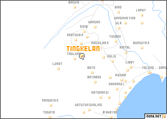
Tingkelan (Davao, Philippines)Tingkelan is a town in the Davao region of Philippines. An overview map of the region around Tingkelan is displayed below.
regional and 3d topo map of Tingkelan, Philippines ::
Tingkelan airports ::
The nearest airport is CEB - Cebu Cotabato, located 133.5 km west of Tingkelan.
Other airports nearby include CGY - Ladag Cagayan De Oro (172.6 km north west), LGP - Legazpi Pagadian (231.4 km west), Nearby towns ::
Tagluno (2.0km west) //
Bato (3.6km south east) //
Pagsiban (3.7km north) //
Alambre (4.6km east) //
Pagsilaan (4.6km north east) //
Pantukan (4.8km north) //
Tagakpan (5.2km north) //
Bayabas (5.7km south east) //
Lumot (6.0km west) //
Sirib (6.3km north) //
Mulig (6.4km east) //
Bato (7.3km south east) //
Wañgan (7.8km north) //
Tugbok (8.4km north east) //
Matopangi (9.3km south east) //
Piedra (9.6km south east) //
Mampangi (10.0km south east) //
Inuayan (10.2km south east) //
Ula (10.6km north east) //
[all distances 'as the bird flies' and approximate]  Places with similar names to Tingkelan, Philippines ::
// Dangcalan (PH)
// Dangkalan (PH)
// Dangkalan (PH)
// Taungkolôn (MM)
// Dongkelan (ID)
// Tangkilan (ID)
// Tung Kalān (PK)
// Tong Koua Lin (LA)
// Tangkulan (PH)
// Tong Qua Lìn (VN)
Disclaimer :: Information on this page comes without warranty of any kind |
||
|
Where is Tingkelan? Elevation and coordinates ::
Latitude (lat): 7°4'36"N Longitude (lon): 125°24'55"E
Elevation (approx.): 561m (map arrows pan, magnifying glasses zoom) |
||
|
Visiting Tingkelan? Hotel/Accommodation ::
Book a hotel in Tingkelan Travel Guide ::
Buy a travel guide for Philippines rental cars ::
car rental offers GPS waypoint ::
download a GPX waypoint (PoI) of Tingkelan for your GPS receiver
|
||