|
search place name
|
||
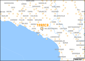
Tranca (Camarines Sur, Philippines)Tranca is a town in the Camarines Sur region of Philippines. An overview map of the region around Tranca is displayed below.
regional and 3d topo map of Tranca, Philippines ::
Tranca airports ::
The nearest airport is KLO - Kalibo, located 215.8 km south of Tranca.
Nearby towns ::
Cotmo (1.9km south) //
Guaran (1.9km south) //
Ngaran (1.8km west) //
Kinaba (1.9km north) //
Bual (2.6km south west) //
Bagolatao (2.6km south east) //
Vical (3.6km west) //
Banligui (3.6km west) //
Ava (3.6km west) //
Naliguid Nagapu (3.6km east) //
Bagulaizo (4.1km south east) //
Maragñi (4.1km north west) //
San Jose (4.1km north west) //
Bunsaran (5.2km north east) //
Buyuan (5.6km north) //
Hobo (5.7km north east) //
Mainit (5.7km west) //
Lupi (5.8km north) //
Antipolo (5.9km north east) //
Cararayan (6.6km south east) //
Colacog (6.6km north west) //
Tagbac (6.6km north west) //
Beberon (6.8km north) //
Grijalvo (7.4km north) //
San Joaquin (7.5km north) //
Tistis (7.4km west) //
Taisan (7.4km east) //
Lampayang (7.4km east) //
Mayburi (7.4km east) //
[all distances 'as the bird flies' and approximate]  Places with similar names to Tranca, Philippines ::
Disclaimer :: Information on this page comes without warranty of any kind |
||
|
Where is Tranca? Elevation and coordinates ::
Latitude (lat): 13°29'0"N Longitude (lon): 123°8'0"E
Elevation (approx.): 231m (map arrows pan, magnifying glasses zoom) |
||
|
Visiting Tranca? Hotel/Accommodation ::
Book a hotel in Tranca Travel Guide ::
Buy a travel guide for Philippines rental cars ::
car rental offers GPS waypoint ::
download a GPX waypoint (PoI) of Tranca for your GPS receiver
|
||