|
search place name
|
||
Unidos (Misamis Occidental, Philippines)Unidos is a town in the Misamis Occidental region of Philippines. An overview map of the region around Unidos is displayed below.
regional and 3d topo map of Unidos, Philippines ::

Unidos airports ::
The nearest airport is LGP - Legazpi Pagadian, located 87.9 km south of Unidos.
Other airports nearby include DGT - Dumaguete (91.2 km north west), CGY - Ladag Cagayan De Oro (105.8 km east), CEB - Cebu Cotabato (168.9 km south), NOP - Masbate Mactan Cebu Intl (192.6 km north), Nearby towns ::
Buenavoluntad (0.9km east) //
Magcamiguing (1.6km south) //
Langob (1.9km north) //
Cadre (2.4km east) //
Agumo (2.8km north east) //
Plaridel (3.3km north east) //
Bato (3.3km west) //
Dokaling (4.4km north) //
Calamba (4.6km south west) //
Santa Cruz (4.9km north east) //
Danao (5.5km north) //
Usucan (5.5km north east) //
Looc (5.8km east) //
Pitosan (6.0km north east) //
Solipat (6.2km south) //
Sinian (6.4km north west) //
Dapacan (6.5km south west) //
Del Pilar (6.5km west) //
Lumipac (6.8km west) //
Libertad (7.2km south west) //
Lagbas (7.3km east) //
Mabini (7.3km west) //
Cartagena (7.6km east) //
Bonifacio (7.7km south) //
Sibugon (8.2km east) //
Salvador (8.4km south west) //
Lupagan (9.0km north west) //
Tugas (9.0km north west) //
Guinabot (9.3km south west) //
[all distances 'as the bird flies' and approximate] 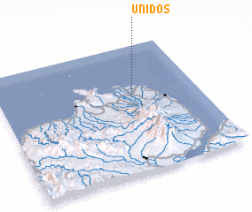 Places with similar names to Unidos, Philippines ::
Disclaimer :: Information on this page comes without warranty of any kind |
||
|
Where is Unidos? Elevation and coordinates ::
Latitude (lat): 8°35'38"N Longitude (lon): 123°40'3"E
Elevation (approx.): 40m (map arrows pan, magnifying glasses zoom) |
||
|
Visiting Unidos? Hotel/Accommodation ::
Book a hotel in Unidos Travel Guide ::
Buy a travel guide for Philippines rental cars ::
car rental offers GPS waypoint ::
download a GPX waypoint (PoI) of Unidos for your GPS receiver
|
||