|
search place name
|
||
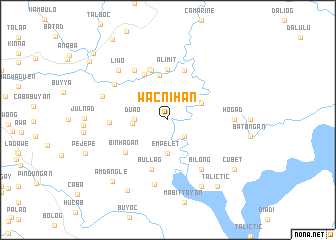
Wacnihan (Ifugao, Philippines)Wacnihan is a town in the Ifugao region of Philippines. An overview map of the region around Wacnihan is displayed below.
regional and 3d topo map of Wacnihan, Philippines ::
Wacnihan airports ::
The nearest airport is BAG - Baguio, located 85.4 km south west of Wacnihan.
Nearby towns ::
Bangao (2.6km south east) //
Duao (3.5km west) //
Empelet (3.7km south) //
Abinuan (3.8km west) //
Anao (4.0km north east) //
Hogngal (5.1km north) //
Alimit (5.6km north) //
Talallang (5.7km north west) //
Maupan (5.8km north) //
Matagguin (5.8km north) //
Bullag (5.8km south) //
Angit (6.0km north) //
Binhagan (5.9km south west) //
Inlamut (6.2km west) //
Inumbog (6.6km north west) //
Bilong (6.6km south east) //
Tanao (7.0km north west) //
Aguaton (7.4km south) //
Hogad (7.1km east) //
Buyabuyan (7.5km west) //
Liwo (7.7km north west) //
Ayañgan (7.7km north west) //
Bactad (8.2km south east) //
Buyabuyan (9.0km south west) //
Cubet (9.0km south east) //
Talictic (9.1km south east) //
Amdangle (9.1km south west) //
Ducligan (10.6km north west) //
Aduyungan (10.8km north west) //
[all distances 'as the bird flies' and approximate]  Places with similar names to Wacnihan, Philippines :: Disclaimer :: Information on this page comes without warranty of any kind |
||
|
Where is Wacnihan? Elevation and coordinates ::
Latitude (lat): 16°51'0"N Longitude (lon): 121°15'0"E
Elevation (approx.): 299m (map arrows pan, magnifying glasses zoom) |
||
|
Visiting Wacnihan? Hotel/Accommodation ::
Book a hotel in Wacnihan Travel Guide ::
Buy a travel guide for Philippines rental cars ::
car rental offers GPS waypoint ::
download a GPX waypoint (PoI) of Wacnihan for your GPS receiver
|
||