|
search place name
|
||
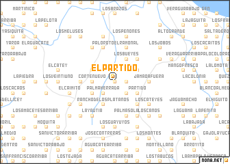
El Partido (Espaillat, Dominican Republic)El Partido is a town in the Espaillat region of Dominican Republic. An overview map of the region around El Partido is displayed below.
regional and 3d topo map of El Partido, Dominican Republic ::
El Partido airports ::
The nearest airport is STI - Santiago Cibao Intl, located 24.0 km south west of El Partido.
Other airports nearby include POP - Puerto Plata Gregorio Luperon Intl (27.1 km north west), SDQ - Santo Domingo Las Americas Intl (147.8 km south east), BRX - Barahona Maria Montez Intl (160.9 km south west), CAP - Cap Haitien Intl (185.8 km west), Nearby towns ::
La Paloma (0.0km north) //
Palma Herrada (1.7km east) //
El Limón (2.5km north east) //
Jamao Afuera (2.5km south east) //
La Jagüita (2.5km south west) //
Los Trastacos (2.5km south west) //
Palma Herrada (2.5km south west) //
Corte Nuevo (3.5km west) //
Los Bueyes (4.1km north east) //
Boca de Partido (4.0km north east) //
El Samán (4.0km south east) //
Partido (4.0km south east) //
Rancho de Los Plátanos (4.1km south west) //
Arroyo Blanco (4.0km north west) //
Cola de Pato (4.0km south west) //
El Manguito (5.1km north east) //
Partido (5.1km south east) //
Jamao Afuera (5.2km east) //
El Saladillo (5.2km west) //
Palmasola (5.8km south) //
El Ramonal (5.8km north) //
El Almendro (5.8km south) //
Arroyo Seco (5.8km south) //
Arroyo de Agua (5.8km north) //
Palo Roto (5.8km north) //
Jamao Adentro (6.6km south east) //
Los Rincones (6.4km south west) //
Los Cateyes (6.4km south east) //
La Yautía (6.6km south west) //
[all distances 'as the bird flies' and approximate]  Places with similar names to El Partido, Dominican Republic ::
// El Puertito (ES)
// El Perdido (GT)
// El Perdido (MX)
// El Perdido (MX)
// El Perdido (MX)
// El Perdido (VE)
// El Perdido (VE)
// El Perdido (AR)
Disclaimer :: Information on this page comes without warranty of any kind |
||
|
Where is El Partido? Elevation and coordinates ::
Latitude (lat): 19°33'0"N Longitude (lon): 70°26'0"W
Elevation (approx.): 374m (map arrows pan, magnifying glasses zoom) |
||
|
Visiting El Partido? Hotel/Accommodation ::
Book a hotel in El Partido Travel Guide ::
rental cars ::
car rental offers GPS waypoint ::
download a GPX waypoint (PoI) of El Partido for your GPS receiver
|
||