|
search place name
|
||
Hervidor (Puerto Plata, Dominican Republic)Hervidor is a town in the Puerto Plata region of Dominican Republic. An overview map of the region around Hervidor is displayed below.
regional and 3d topo map of Hervidor, Dominican Republic ::

Hervidor airports ::
The nearest airport is POP - Puerto Plata Gregorio Luperon Intl, located 24.9 km east of Hervidor.
Other airports nearby include STI - Santiago Cibao Intl (38.5 km south east), CAP - Cap Haitien Intl (146.3 km west), BRX - Barahona Maria Montez Intl (163.9 km south), SDQ - Santo Domingo Las Americas Intl (184.2 km south east), Nearby towns ::
Los Uveros (0.0km north) //
Boca de Río Grande (0.0km north) //
Palmar Grande (0.0km north) //
Los Prieto (1.9km south) //
Río Grande Abajo (1.9km south) //
Las Aromas (1.7km west) //
La Media Luna (1.7km west) //
La Llanada (1.7km east) //
Bellaco (1.9km north) //
Agua Larga (1.7km east) //
Pozo Prieto (1.7km east) //
La Atravesada (2.5km south west) //
Boca de Río Blanco (2.5km south east) //
Guanábano (2.5km north west) //
Las Bonillas (2.5km north west) //
La Pared (3.5km east) //
El Alto del Fundo (3.7km south) //
La Catalina (3.7km south) //
Los Arroyos (3.5km west) //
Alto de la Damajagua (4.0km south east) //
Los Manantiales (4.0km north east) //
El Alto de la Loma (4.0km north east) //
Río Grande al Medio (4.1km south east) //
El Cumbí (4.1km south east) //
Los Ciruelos (4.1km south east) //
La Solapa (4.1km south east) //
La Guama (4.1km south east) //
Naranjo Chino (4.1km north east) //
Boca de Obispo (4.1km north west) //
[all distances 'as the bird flies' and approximate] 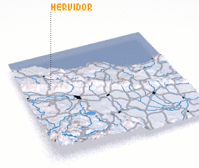 Places with similar names to Hervidor, Dominican Republic ::
Disclaimer :: Information on this page comes without warranty of any kind |
||
|
Where is Hervidor? Elevation and coordinates ::
Latitude (lat): 19°42'0"N Longitude (lon): 70°48'0"W
Elevation (approx.): 213m (map arrows pan, magnifying glasses zoom) |
||
|
Visiting Hervidor? Hotel/Accommodation ::
Book a hotel in Hervidor Travel Guide ::
rental cars ::
car rental offers GPS waypoint ::
download a GPX waypoint (PoI) of Hervidor for your GPS receiver
|
||