|
search place name
|
||
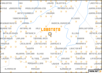
La Batata (Distrito Nacional, Dominican Republic)La Batata is a town in the Distrito Nacional region of Dominican Republic. An overview map of the region around La Batata is displayed below.
regional and 3d topo map of La Batata, Dominican Republic ::
La Batata airports ::
The nearest airport is SDQ - Santo Domingo Las Americas Intl, located 19.2 km south of La Batata.
Other airports nearby include LRM - La Romana Casa De Campo Intl (78.0 km east), PUJ - Punta Cana Intl (134.1 km east), STI - Santiago Cibao Intl (135.7 km north west), POP - Puerto Plata Gregorio Luperon Intl (161.7 km north west), Nearby towns ::
Buena Vista (0.0km north) //
Mata de Piedra (1.9km south) //
Las Barías (1.8km west) //
El Aguacate (2.6km north east) //
El Peje (2.6km south east) //
La Joya (2.6km south west) //
El Cachón (3.7km south) //
La Lechuga (3.5km west) //
Juanajico (4.1km south east) //
Las Parras (4.1km north west) //
El Ají (4.1km south west) //
Maricarmen (4.0km north west) //
Valentín (4.0km north west) //
Tierra Blanca (4.0km south west) //
El Copado (4.0km south west) //
Ahorca Los Perros (5.1km north east) //
El Barrero (5.1km south west) //
Los Tocones (5.1km south west) //
El Alto (5.1km south west) //
La Granja (5.3km west) //
Los Cocos (5.3km west) //
Cuenca (5.3km west) //
Ismael Jiménez (5.8km south) //
Las Garzas (5.8km south) //
Los Cimarrones (5.6km west) //
Los Urbanos (6.6km south east) //
Estorga (6.6km south east) //
El Contador (7.0km east) //
La Guama (7.4km north) //
[all distances 'as the bird flies' and approximate]  Places with similar names to La Batata, Dominican Republic ::
// Labatat (PH)
// Libutad (PH)
// Lebotuto (TP)
// Léboudou Doué (SN)
// La Beatita (PE)
// Labadaad (SO)
// Labatut (FR)
// Labatut (FR)
// Labatut (FR)
// La Baitoíta (DO)
Disclaimer :: Information on this page comes without warranty of any kind |
||
|
Where is La Batata? Elevation and coordinates ::
Latitude (lat): 18°36'0"N Longitude (lon): 69°38'0"W
Elevation (approx.): 27m (map arrows pan, magnifying glasses zoom) |
||
|
Visiting La Batata? Hotel/Accommodation ::
Book a hotel in La Batata Travel Guide ::
rental cars ::
car rental offers GPS waypoint ::
download a GPX waypoint (PoI) of La Batata for your GPS receiver
|
||