|
search place name
|
||
Villa Augusta (Buenos Aires, Argentina)Villa Augusta is a town in the Buenos Aires region of Argentina. An overview map of the region around Villa Augusta is displayed below.
regional and 3d topo map of Villa Augusta, Argentina ::

Villa Augusta airports ::
The nearest airport is AEP - Buenos Aires Aeroparque Jorge Newbery, located 26.0 km north west of Villa Augusta.
Other airports nearby include LPG - La Plata (40.8 km south east), MVD - Montevideo Angel S Adami (181.8 km east), GHU - Gualeguaychu (195.9 km north), Nearby towns ::
Ezpeleta (1.9km south) //
Berazategui (1.9km north) //
Villa D. Sobral (2.4km south east) //
Quilmes (3.8km north west) //
Villa España (4.9km east) //
Gobernador Monteverde (5.8km south) //
Villa San Francisco (4.9km east) //
Don Bosco (6.3km north west) //
Villa Giambruno (6.3km south east) //
Bernal (5.9km north west) //
Estanislao S. Zeballos (7.4km south) //
Bosques (7.6km south) //
Ranelagh (7.2km south east) //
San Francisco Solano (7.1km south west) //
Plátanos (7.1km south east) //
Wilde (8.2km north west) //
Villa Domínico (9.6km north west) //
[all distances 'as the bird flies' and approximate] 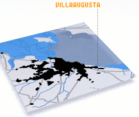 Places with similar names to Villa Augusta, Argentina ::
// Vehlgast (DE)
// Velgast (DE)
// Villigst (DE)
// Veligostí (GR)
// Vila Augusta (PT)
// Felcsút (HU)
// Velgošti (MK)
// Falquesito (PE)
// Flacksta (SE)
// Folkesta (SE)
Disclaimer :: Information on this page comes without warranty of any kind |
||
|
Where is Villa Augusta? Elevation and coordinates ::
Latitude (lat): 34°45'0"S Longitude (lon): 58°15'0"W
Elevation (approx.): 13m (map arrows pan, magnifying glasses zoom) |
||
|
Visiting Villa Augusta? Hotel/Accommodation ::
Book a hotel in Villa Augusta Travel Guide ::
Buy a travel guide for Argentina rental cars ::
car rental offers GPS waypoint ::
download a GPX waypoint (PoI) of Villa Augusta for your GPS receiver
|
||