|
search place name
|
||
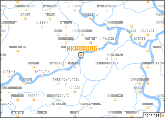
Hkanaung (Ayeyarwady, Myanmar)Hkanaung is a town in the Ayeyarwady region of Myanmar. An overview map of the region around Hkanaung is displayed below.
regional and 3d topo map of Hkanaung, Myanmar ::
Hkanaung airports ::
The nearest airport is RGN - Yangon Intl, located 86.4 km north east of Hkanaung.
Nearby towns ::
Taman (2.6km north east) //
Asigale (2.6km south west) //
Ywathit (4.1km north east) //
Kanzu (4.0km north west) //
Amawchok (5.1km north west) //
Kalaungbôn (5.6km north) //
Tettēzu (5.3km east) //
Teinbin Petala (5.6km east) //
Myingagôn (5.6km west) //
Minhlazu (6.5km north east) //
Kalāgyi (6.6km north west) //
The-eingyaungzu (6.6km south west) //
Htalunzu (7.1km east) //
Kôndan (7.6km south) //
Akaw (7.7km north west) //
Thayagon (7.7km south west) //
Kyunpa (8.2km north west) //
Pabēzu (9.1km north east) //
Magwedan (10.3km north east) //
[all distances 'as the bird flies' and approximate] 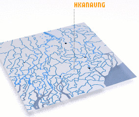 Places with similar names to Hkanaung, Myanmar ::
Disclaimer :: Information on this page comes without warranty of any kind |
||
|
Where is Hkanaung? Elevation and coordinates ::
Latitude (lat): 16°21'0"N Longitude (lon): 95°34'0"E
Elevation (approx.): 4m (map arrows pan, magnifying glasses zoom) |
||
|
Visiting Hkanaung? Hotel/Accommodation ::
Book a hotel in Hkanaung Travel Guide ::
Buy a travel guide for Myanmar rental cars ::
car rental offers GPS waypoint ::
download a GPX waypoint (PoI) of Hkanaung for your GPS receiver
|
||