|
search place name
|
||
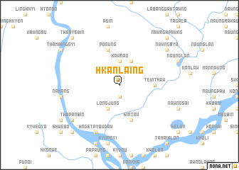
Hkanlaing (Kachin State, Myanmar)Hkanlaing is a town in the Kachin State region of Myanmar. An overview map of the region around Hkanlaing is displayed below.
regional and 3d topo map of Hkanlaing, Myanmar ::
Hkanlaing airports ::
The nearest airport is MYT - Myitkyina, located 110.0 km north of Hkanlaing.
Other airports nearby include LSH - Lashio (167.3 km south), Nearby towns ::
Longjung (1.9km south) //
Kawnan (3.7km north) //
Longjung (4.1km south west) //
Tawka (4.1km north east) //
Dumhpawng (4.1km north east) //
Teinthaw (5.1km east) //
Sintaw (5.8km south) //
Po Aung (5.8km north) //
Hngetpyawdaw (8.1km south west) //
Thapanbin (8.7km south west) //
Nawngbya (8.7km north east) //
Myazedi (10.0km south west) //
Thabyebin (10.0km north west) //
Pulaung (10.0km north west) //
Nawnghpawng (10.0km north east) //
[all distances 'as the bird flies' and approximate]  Places with similar names to Hkanlaing, Myanmar ::
// Canlinga (PH)
// Canlung (PH)
// Canoling (PH)
// Kanlingo (PH)
// Kanoling (PH)
// Kanoling (PH)
// Kanalenga (CD)
// Cannalonga (IT)
// Kan-lin-kou (TW)
// Qinling (CN)
Disclaimer :: Information on this page comes without warranty of any kind |
||
|
Where is Hkanlaing? Elevation and coordinates ::
Latitude (lat): 24°24'0"N Longitude (lon): 97°12'0"E
Elevation (approx.): 437m (map arrows pan, magnifying glasses zoom) |
||
|
Visiting Hkanlaing? Hotel/Accommodation ::
Book a hotel in Hkanlaing Travel Guide ::
Buy a travel guide for Myanmar rental cars ::
car rental offers GPS waypoint ::
download a GPX waypoint (PoI) of Hkanlaing for your GPS receiver
|
||