|
search place name
|
||
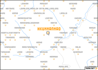
Hkümmanmaö (Shan, Myanmar)Hkümmanmaö is a town in the Shan region of Myanmar. An overview map of the region around Hkümmanmaö is displayed below.
regional and 3d topo map of Hkümmanmaö, Myanmar ::
Hkümmanmaö airports ::
The nearest airport is LSH - Lashio, located 86.7 km east of Hkümmanmaö.
Other airports nearby include MDL - Mandalay Intl (155.0 km south west), Nearby towns ::
Kawngpalai (1.7km west) //
Hkümmànkaü (1.7km west) //
Mamo (1.9km north) //
Mannamset (3.9km north west) //
Mánkáng (3.9km north west) //
Mánweng (4.1km south east) //
Kat-tao (4.1km south east) //
Manpön (4.1km south east) //
Konsáng (3.9km south east) //
Namtoi (4.1km north east) //
Honwo (5.0km south west) //
Konkyem (5.0km south east) //
Namson (5.0km south east) //
Tawmawn (5.1km east) //
Mongngaw (5.1km east) //
Loipyek (5.6km north) //
Manhwe (5.8km south) //
Loisammán (6.3km north west) //
Kengkai (7.6km south) //
Mánloipántang (7.1km west) //
Pàmaö (7.6km south east) //
Kawnhsilám (8.2km north west) //
Pangtong South (8.8km south west) //
Pangtong North (8.8km south west) //
Pangtong (8.8km south west) //
Langloi (9.0km north east) //
Loiseng (10.1km south west) //
[all distances 'as the bird flies' and approximate] 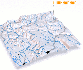 Places with similar names to Hkümmanmaö, Myanmar ::
// Gomen Āmba (ET)
// Quamnum (ET)
// Gombe-Niama (CD)
// Gombeniama (CD)
// Kamnamo (ZM)
// Kamnam (KR)
// Kamnum (PG)
// Komonum (PG)
// Kuminim (PG)
// Kumnamba (SO)
Disclaimer :: Information on this page comes without warranty of any kind |
||
|
Where is Hkümmanmaö? Elevation and coordinates ::
Latitude (lat): 22°47'0"N Longitude (lon): 96°56'0"E
Elevation (approx.): 1018m (map arrows pan, magnifying glasses zoom) |
||
|
Visiting Hkümmanmaö? Hotel/Accommodation ::
Book a hotel in Hkümmanmaö Travel Guide ::
Buy a travel guide for Myanmar rental cars ::
car rental offers GPS waypoint ::
download a GPX waypoint (PoI) of Hkümmanmaö for your GPS receiver
|
||