|
search place name
|
||
Kalaba (Rakhine, Myanmar)Kalaba is a town in the Rakhine region of Myanmar. An overview map of the region around Kalaba is displayed below.
regional and 3d topo map of Kalaba, Myanmar ::

Kalaba airports ::
The nearest airport is KYP - Kyaukpyu, located 10.5 km north of Kalaba.
Other airports nearby include AKY - Sittwe (111.3 km north west), SNW - Thandwe (127.1 km south east), Nearby towns ::
Minde (2.5km north east) //
Pyunshe (2.5km north west) //
Chaung-wa (3.7km south) //
Gawdu (3.5km west) //
Thinchaung (4.0km south east) //
Yenandaung (4.1km south east) //
Zinchaung (4.0km south east) //
Pyade (4.0km north east) //
Pyinseikke (4.1km north east) //
Kande (4.1km north east) //
Kathahpe (5.1km north east) //
Leikkamaw (5.1km north west) //
Minbyin (5.8km south) //
Pachwin (6.4km south east) //
Malakyun (6.6km north west) //
Taungmaw (7.0km east) //
Ôndaw (7.4km north) //
Shaukchaung (7.6km north east) //
Chaungmyaw (9.1km south east) //
Zaingchaung (10.2km north east) //
[all distances 'as the bird flies' and approximate] 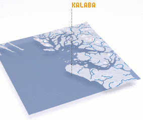 Places with similar names to Kalaba, Myanmar ::
Disclaimer :: Information on this page comes without warranty of any kind |
||
|
Where is Kalaba? Elevation and coordinates ::
Latitude (lat): 19°20'0"N Longitude (lon): 93°31'0"E
Elevation (approx.): 12m (map arrows pan, magnifying glasses zoom) |
||
|
Visiting Kalaba? Hotel/Accommodation ::
Book a hotel in Kalaba Travel Guide ::
Buy a travel guide for Myanmar rental cars ::
car rental offers GPS waypoint ::
download a GPX waypoint (PoI) of Kalaba for your GPS receiver
|
||