|
search place name
|
||
Könghsān (Shan, Myanmar)Könghsān is a town in the Shan region of Myanmar. An overview map of the region around Könghsān is displayed below.
regional and 3d topo map of Könghsān, Myanmar ::

Könghsān airports ::
The nearest airport is LSH - Lashio, located 67.8 km north east of Könghsān.
Other airports nearby include MDL - Mandalay Intl (172.2 km south west), HEH - Heho (198.8 km south), MOG - Mong Hsat (283.0 km south east), Nearby towns ::
Nam-yang (0.0km north) //
Man-wat (0.0km north) //
Kawng-lang (2.5km north east) //
Nyawnghtawk (2.5km north east) //
Nāhpai (3.7km south) //
Namsaw (3.9km south west) //
Hönghkam (3.9km south west) //
Hkai-aw (3.9km south west) //
Pāng-möng (4.1km south east) //
Könghsān (4.1km south west) //
Maksawk (5.0km south west) //
Mengleüng (5.5km west) //
Nawngmawn (5.8km south) //
Nampyan (6.5km north east) //
Nā-makhkaw (6.3km south west) //
Ho-na (6.3km north east) //
Loi-hkwe (6.9km east) //
Pāngwo (6.9km west) //
Kawnglāng (7.4km north) //
Hang-ke (7.6km south) //
Na-ong (7.1km east) //
Sanghse (7.1km west) //
Hkaihsi (7.6km north) //
Hpakhi (7.6km north west) //
Na-lin (7.6km south east) //
Nā-keng (8.2km south east) //
Nā-long (8.2km south east) //
Nawngheng (9.0km north west) //
Man Kongmu (9.0km north east) //
[all distances 'as the bird flies' and approximate] 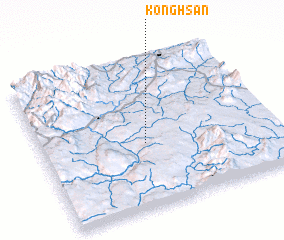 Places with similar names to Könghsān, Myanmar ::
// Könghausen (DE)
// Kang-hsien (TW)
// Kang-hsien (TW)
// Kawng-hsan (MM)
// Kawnghsan (MM)
// Kawnghsan (MM)
// Könghsān (MM)
Disclaimer :: Information on this page comes without warranty of any kind |
||
|
Where is Könghsān? Elevation and coordinates ::
Latitude (lat): 22°26'0"N Longitude (lon): 97°27'0"E
Elevation (approx.): 708m (map arrows pan, magnifying glasses zoom) |
||
|
Visiting Könghsān? Hotel/Accommodation ::
Book a hotel in Könghsān Travel Guide ::
Buy a travel guide for Myanmar rental cars ::
car rental offers GPS waypoint ::
download a GPX waypoint (PoI) of Könghsān for your GPS receiver
|
||