|
search place name
|
||
Kon-mahat (Kachin State, Myanmar)Kon-mahat is a town in the Kachin State region of Myanmar. An overview map of the region around Kon-mahat is displayed below.
regional and 3d topo map of Kon-mahat, Myanmar ::

Kon-mahat airports ::
The nearest airport is MYT - Myitkyina, located 129.8 km north of Kon-mahat.
Other airports nearby include LSH - Lashio (147.1 km south), Nearby towns ::
U-ni-ya (1.9km north) //
Bodewa (1.7km east) //
Kangyi (1.9km south) //
Aw-ka-tha (2.5km south west) //
Kabani (2.5km south east) //
Sihet (3.4km east) //
Mān Ho (3.4km east) //
Kyunkon (3.9km south east) //
Naungka (5.0km north west) //
Theinlin (5.0km south east) //
Mān Hpa (5.1km east) //
Pyinga (5.1km west) //
Bhamo (5.6km north) //
Kho-kyin (5.1km east) //
Thabye-gon (5.4km west) //
Ye-ni (5.4km west) //
Kantha (5.4km west) //
Kaungsin (6.5km north west) //
Mān Yut (6.3km south east) //
Nanmapwe (6.3km south east) //
Nyaungbindat (6.5km north east) //
Naungkhan (7.4km north) //
Sampenago (7.4km north) //
Konkha (7.6km north) //
Letpandan (7.0km west) //
Nayo (7.5km north east) //
Konywagyi (7.5km south west) //
Si-in (7.7km north east) //
Mān Kang (7.7km south east) //
[all distances 'as the bird flies' and approximate] 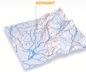 Places with similar names to Kon-mahat, Myanmar :: Disclaimer :: Information on this page comes without warranty of any kind |
||
|
Where is Kon-mahat? Elevation and coordinates ::
Latitude (lat): 24°13'0"N Longitude (lon): 97°14'0"E
Elevation (approx.): 105m (map arrows pan, magnifying glasses zoom) |
||
|
Visiting Kon-mahat? Hotel/Accommodation ::
Book a hotel in Kon-mahat Travel Guide ::
Buy a travel guide for Myanmar rental cars ::
car rental offers GPS waypoint ::
download a GPX waypoint (PoI) of Kon-mahat for your GPS receiver
|
||