|
search place name
|
||
Kunkawk (Shan, Myanmar)Kunkawk is a town in the Shan region of Myanmar. An overview map of the region around Kunkawk is displayed below.
regional and 3d topo map of Kunkawk, Myanmar ::

Kunkawk airports ::
The nearest airport is LSH - Lashio, located 97.2 km north of Kunkawk.
Other airports nearby include HEH - Heho (192.3 km south west), KET - Kengtung (197.9 km south east), MDL - Mandalay Intl (207.2 km west), MOG - Mong Hsat (224.1 km south east), Nearby towns ::
Ho-tong (0.0km north) //
Möng La (1.9km north) //
Loi-wing (1.7km east) //
Nā-hi (2.5km north west) //
Longkeng (2.5km south east) //
Nā-mawng (3.7km north) //
Māk-monghsung (3.4km east) //
Pa-tep (4.1km north east) //
Lwe-hsan (3.9km north east) //
Mān Kang (4.1km south west) //
Wengleng (3.9km south east) //
Nam-un (3.9km south east) //
Mān Sawn (5.1km south east) //
Hko-nim (5.2km east) //
Kunhong (5.2km east) //
Tai-hkö (5.2km east) //
Namhu (5.6km north) //
Hkai-yu (5.6km north) //
Namhkai-kongsong (5.8km south) //
Nawngleng (6.3km north east) //
Mān Tap (6.3km north east) //
Hwe-kut (6.3km south west) //
Kungkaw (6.3km south east) //
Nā-ung (7.4km north) //
Nawnghkio (7.1km east) //
Mān Wap (7.6km south east) //
Namhkim (8.2km north east) //
Namhu (8.2km south west) //
Maklang (8.2km south west) //
[all distances 'as the bird flies' and approximate] 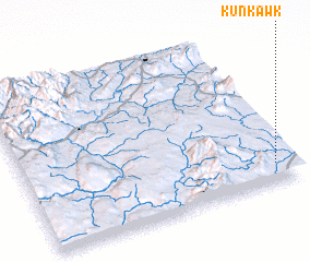 Places with similar names to Kunkawk, Myanmar ::
Disclaimer :: Information on this page comes without warranty of any kind |
||
|
Where is Kunkawk? Elevation and coordinates ::
Latitude (lat): 22°7'0"N Longitude (lon): 97°56'0"E
Elevation (approx.): 838m (map arrows pan, magnifying glasses zoom) |
||
|
Visiting Kunkawk? Hotel/Accommodation ::
Book a hotel in Kunkawk Travel Guide ::
Buy a travel guide for Myanmar rental cars ::
car rental offers GPS waypoint ::
download a GPX waypoint (PoI) of Kunkawk for your GPS receiver
|
||