|
search place name
|
||
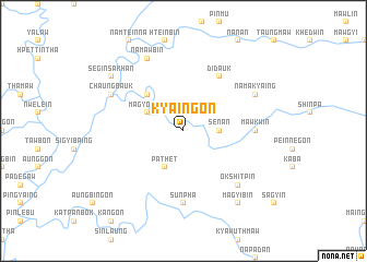
Kya-ingon (Sagaing, Myanmar)Kya-ingon is a town in the Sagaing region of Myanmar. An overview map of the region around Kya-ingon is displayed below.
regional and 3d topo map of Kya-ingon, Myanmar ::
Kya-ingon airports ::
The nearest airport is IMF - Imphal, located 176.9 km west of Kya-ingon.
Other airports nearby include MYT - Myitkyina (229.4 km north east), Nearby towns ::
Aunggon (2.5km north west) //
Senan (3.4km east) //
Magyobyit (3.9km north west) //
Pathet (4.1km south west) //
Mansigale (5.0km north west) //
Didauk (6.5km north east) //
Mawkwin (6.8km east) //
Sunpha (7.4km south) //
Okshitpin (7.5km south east) //
Namakyaing (7.7km north east) //
Namawbin (8.1km north west) //
Chaungbauk (7.7km north west) //
Magyibin (9.0km south east) //
Segin Sakhan (8.8km north west) //
[all distances 'as the bird flies' and approximate]  Places with similar names to Kya-ingon, Myanmar ::
// Caayongan (PH)
// Guyangan (ID)
// Guyangan (ID)
// Guyangan (ID)
// Guyangan (ID)
// Guyangan (ID)
// Guyangan (ID)
// Kayan Keyna (NE)
// Kaehyŏng-ni (KP)
// Kayang-ni (KP)
Disclaimer :: Information on this page comes without warranty of any kind |
||
|
Where is Kya-ingon? Elevation and coordinates ::
Latitude (lat): 24°10'0"N Longitude (lon): 95°31'0"E
Elevation (approx.): 355m (map arrows pan, magnifying glasses zoom) |
||
|
Visiting Kya-ingon? Hotel/Accommodation ::
Book a hotel in Kya-ingon Travel Guide ::
Buy a travel guide for Myanmar rental cars ::
car rental offers GPS waypoint ::
download a GPX waypoint (PoI) of Kya-ingon for your GPS receiver
|
||