|
search place name
|
||
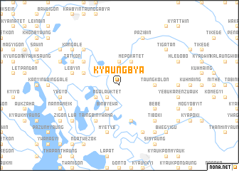
Kyaungbya (Myanmar)Kyaungbya is a town in Myanmar. An overview map of the region around Kyaungbya is displayed below.
regional and 3d topo map of Kyaungbya, Myanmar ::
Kyaungbya airports ::
The nearest airport is RGN - Yangon Intl, located 180.5 km south of Kyaungbya.
Nearby towns ::
Ngalauktet (2.6km south west) //
Mèpok Ale (3.7km north) //
Ngalauktet (4.0km south west) //
Binbyēwa (4.1km south west) //
Mèpok Atet (4.1km north east) //
Taungkolôn (5.3km east) //
Kyunbinzeik (5.6km west) //
Migyaunggaung (5.8km south) //
Taingbin Ywama (6.6km south west) //
Bèbe (6.4km south east) //
Pawkadaung (6.4km south east) //
Naungbo (6.4km north west) //
Myetyè (7.6km south) //
Memezu (7.3km west) //
Lèbyin (7.3km west) //
Inhlashe (7.7km north west) //
Tiboki (7.7km south east) //
Shangyaung (8.2km south east) //
Shanywathit (8.2km south east) //
Tatkon (7.9km north west) //
Talo (7.9km north west) //
Pazibin (8.2km north east) //
Tiloki (9.1km south east) //
Kangale (9.0km north west) //
Lu-a (9.0km south west) //
Tigatan (9.0km north east) //
Bwègyigu (10.2km south east) //
[all distances 'as the bird flies' and approximate] 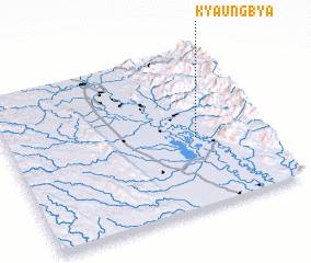
Disclaimer :: Information on this page comes without warranty of any kind |
||
|
Where is Kyaungbya? Elevation and coordinates ::
Latitude (lat): 18°26'0"N Longitude (lon): 96°44'0"E
Elevation (approx.): 35m (map arrows pan, magnifying glasses zoom) |
||
|
Visiting Kyaungbya? Hotel/Accommodation ::
Book a hotel in Kyaungbya Travel Guide ::
Buy a travel guide for Myanmar rental cars ::
car rental offers GPS waypoint ::
download a GPX waypoint (PoI) of Kyaungbya for your GPS receiver
|
||